Continued Warm, Storms Later this Week
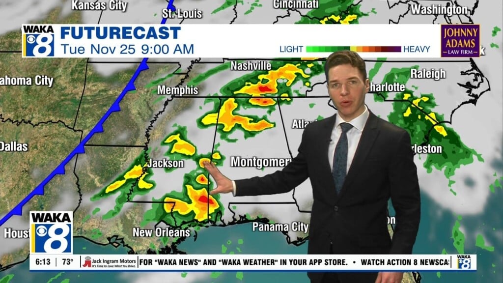
PATTERN BECOMES MORE ACTIVE: The ridge continues to influence our weather by keeping us very warm with southerly flow, while brutally cold air, ice and snow are in place across the northern U.S. The good news is that for the next eight days or so, the upper air pattern won’t allow the cold air to move southward and we will continue to remain unseasonably warm. However, the ridge does weaken some, and we are going to see a more active southwesterly flow that will allow for several rounds of rain, and perhaps some strong storms to return to Alabama through the weekend.
RAIN CHANCES ON THE INCREASE: A weakening surface front will bring the chance of showers to part of the state this afternoon and tonight, but with little dynamic support, that means no severe weather, and likely little to no thunder. Rainfall amounts should be on the light side, with less than one-half inch expected. Slightly drier air works into the state Wednesday with generally dry conditions and only a few scattered showers. The high will drop back slightly into the mid 70s Wednesday.
SYSTEM NUMBER ONE: Embedded in the southwesterly flow will be upper level waves that will traverse the Southeast, and these will allow for showers and storms to return to Alabama. The next wave approaching from the west will bring more rain to Alabama Thursday afternoon and especially Thursday night. Some strong storms are certainly possible, as unstable air streams north from the Gulf and shear values increase, but the overall severe weather threat looks low. For Friday, showers and storms will be ending from west to east across the state as drier air will move in through the day. Friday will still be warm with highs in the mid 70s.
SYSTEM NUMBER TWO: This is the one that looks to be the more potent system and could allow for a greater chance of strong storms to severe storms to impact Alabama late Saturday and into Sunday. A strong upper trough will support a deepening surface low to the west of Alabama, and as this system moves across the state, rain and storms will return. The SPC has already highlighted the southern half of the state in a threat of severe storms. I would not be surprised to see this threat area expanded north by the end of the week. As far as the overall severe weather threat, it is still too early to be really specific on the threat; just something to watch and keep in mind heading into the weekend. Storms or not, very beneficial rain is expected the next seven days, with one to three inches possible in many places, which will continue to combat the drought conditions that persist over parts of the state.
VOODOOLAND: Early next week, cooler air returns to the state. Still nothing too unseasonably cold, but it look as though January will start feeling like January again. That means highs back into the upper 50s and lower 60. Beyond that, still looking for a pattern flip, which will allow for northwesterly flow, meaning more cold weather.
Be sure to stay connected throughout the day and night follow me on twitter: @Ryan_Stinnett and Like my Facebook Fan Page “Meteorologist Ryan Stinnett.”
Have a great day!
Ryan


