Several Inches Of Rain Possible Through Thursday
Clouds and rain returned to our area this morning, and it may be some time before we see a return to abundant sunshine. Several inches of rain could fall across our area through Thursday. There may also be a threat for severe storms Wednesday. In the meantime, expect more showers and a few thunderstorms this afternoon. The coverage of rain looks to be fairly widespread through this evening, but we may see a lull in activity overnight. Still, it would be a good idea to have rain gear on hand this evening. Expect a cloudy sky and warm temperatures otherwise. We’ll generally hover in the low to mid 60s between 7 and 11 PM. Overnight lows only fall to near 60°.
Another round of showers and perhaps a few storms could greet us Tuesday morning. If you’re planning to vote, you may have to dodge rain drops at just about any time during the day. Showers and storms appear likely throughout the day as a cold front advances south through our area. Tuesday looks quite warm, with highs in the low to mid 70s. The front pushes south of our area Tuesday night, which could result in a relative lull in rain again. However, the front stalls just to our south, then returns north as a warm front Wednesday.
Just how far north the front moves will be key Wednesday. There exists some potential for severe weather, especially south of the front. There, all modes of severe weather (tornadoes, damaging straight-line winds, hail) are possible. However, even just north of the front, storms capable of large hail could develop. At this time, the storm prediction center places a marginal (level 1/5) risk for severe weather across south Alabama on Wednesday. There’s a slight (level 2/5) risk for coastal sections of Alabama and northwest Florida. Based on current model guidance, it seems most likely that the warm front hugs the northern gulf coast and remains south of our area. However, that is still subject to change, and we’ll keep an eye on it.
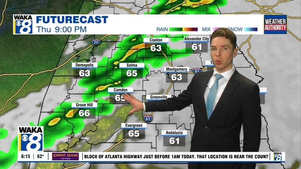
If there is a chance for severe weather, it looks like it would be late Wednesday afternoon/Wednesday night for our area. Rain continues on Thursday as an area of surface low pressure moves just to our east. The system finally clears our area on Friday, with sunshine returning. Again, outside any severe weather potential Wednesday, heavy rain looks like a significant threat this week. Area rain totals could easily reach 3-4″, with locally higher amounts of 4-6″ possible. Flash flooding and river rises could become a problem.
Expect cooler temperatures behind the system. Highs only reach the 60s Friday and Saturday, with lows potentially falling into the 30s each night. Friday and Saturday also feature abundant sunshine. Clouds may increase a bit Sunday, but it looks dry and warmer otherwise with highs near 70°. Some rain could sneak into our area late next Monday, but better chances for rain likely arrive near the middle of next week.