Elevated Rain Chances Later This Week
Memorial day is off to a warm and dry start with temperatures in the 60s to low 70s. It seems like there’s a little less mugginess in the air this morning. Winds are currently out of the east, and that should be the case for the rest of the day. The east wind could keep temperatures in the upper 80s across eastern Alabama, but highs in the low 90s are possible across southern and western Alabama. Showers and storms could develop in the daytime heating, but looks like they are hit-or-miss in nature for today. Most of the rain comes to a close overnight, with an otherwise mostly cloudy sky. Lows fall into the upper 60s.
Showers and storms look more numerous Tuesday. That, in addition to more cloudiness, likely holds high temperatures in the low to mid 80s. Most of the rain tapers off Tuesday evening, but Tuesday night remains mostly cloudy, warm, and muggy with lows in the upper 60s. Showers and storms could be the most widespread Wednesday, also helping to hold high temperatures down.
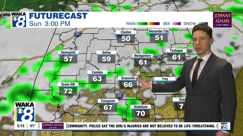
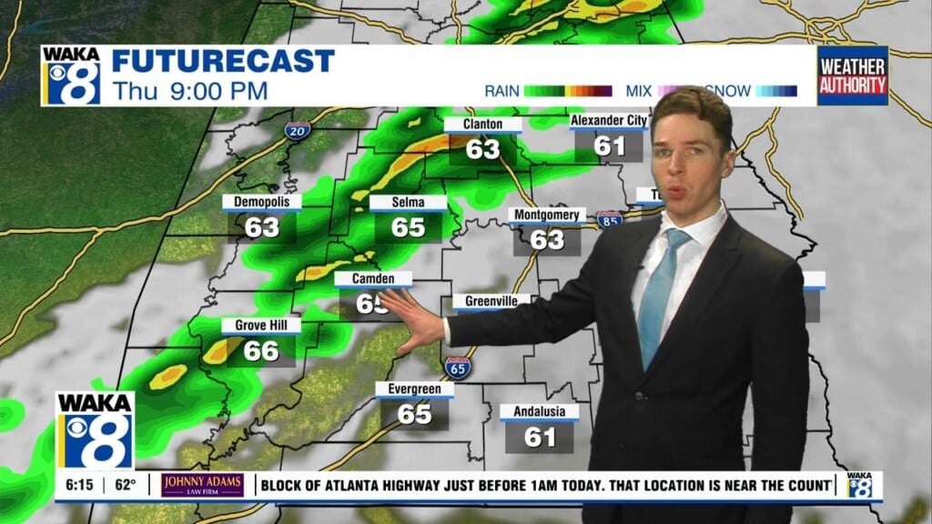
The chance for rain remains elevated Thursday, but rain chances appear to decrease this weekend. Afternoon high temperatures respond by reaching the low 90s Saturday and Sunday. Overnight lows only fall to near 70°. June begins next Monday, and early indications show more upper 80/low 90° heat.