Warm and Wet Start to the Week
WARM AND WET START TO WEEK: A cold front will approach Alabama today and out ahead of it, we are seeing strong southerly flow off the Gulf allowing for more clouds than sun, scattered showers, and warm temperatures as highs today will surge well into the 70s. Tonight, more widespread rain and storms are expected, and though a strong storm or two may be possible, the severe weather threat is near zero. The front stalls across Central and South Alabama tomorrow, allowing for continued areas of rain and storms for Tuesday and Wednesday with temperatures in the 60s and 70s. Rainfall totals of 1-2 inches are possible by the time the rain ends late Wednesday.
COOLER AND DRIER END TO WEEK: Another cold front will come plowing through the state late Wednesday and will bring an end to the rain as high pressure builds into the area to end the week, bringing cooler and drier weather. The sky will be sunny and highs fall back into the 50s with nights around the freezing mark for both Thursday and Friday.
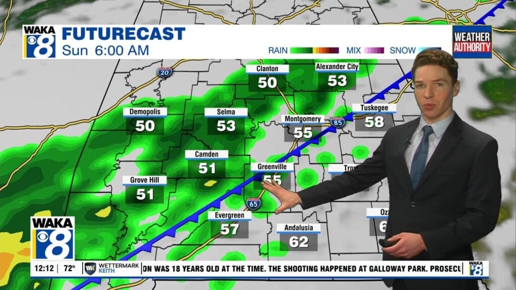
WEEKEND WEATHER: Temperatures will make a decent bounce back on Saturday with highs in the lower 60s, but clouds will be on the increase through the day. Rain chances return late Saturday night and through the day Sunday with showers and storms back in the forecast. Highs Sunday surge back into the upper 60s and lower 70s.
Have a Monday full of mystery!!!
Ryan