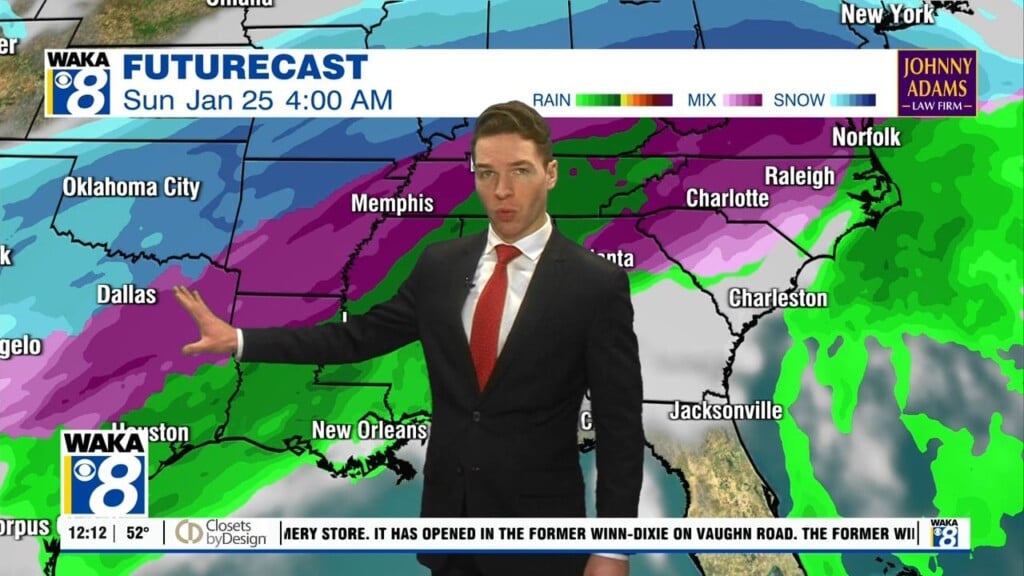
Rain, Freezing Rain, & Sleet Monday
A dynamic winter weather system is setting up to be a big headache for parts of the deep south tonight into Monday. A large area of north and west Alabama will be impacted by this system. Freezing rain will be the greatest threat to areas between Huntsville and Tuscaloosa. Some significant impacts including dangerous travel conditions to numerous power outages. We suggest you think twice before making any plans to head towards north Alabama late tonight through Tuesday.
Closer to home, we have the wintry threat in our western counties including Hale, Marengo, and Perry county. Freezing rain leading to ice build up could cause difficult travel and produce sporadic power outages. Extreme caution is advised for Monday into Tuesday morning. Temps are going to be very cold with lows down in the lower 20s. Gusty northwest winds of 10-15 mph will make it feel more like the teens.
Fortunately for the majority of our area, it’s a cold rain Monday. All the precipitation will exit just as the Arctic air spreads across the rest of the area. Temps will fall into the mid 20s overnight. Areas of standing water from recent rains will need to be watched for black ice Tuesday morning. Tuesday is looking sunny but it will still be a cold day with temps only managing the 40s for highs.
We get a midweek break in the action as most spots receive ample sunshine to dry things out a bit. Temps try to recover and highs hover in the upper 50s to around 60 degrees. Our winds become southeasterly and moisture heads back into the area. Looks like we stay dry until late Wednesday night.
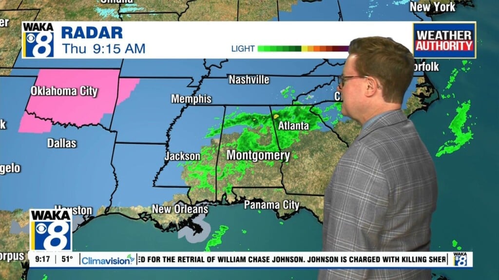
Thursday is looking wet with rain and even a few t-storms. An area of low pressure along with a trailing cold front will kick off the active weather. The system quickly exits our area late Thursday night and we’re looking at clearing and colder weather conditions to settle over us Friday. High pressure returns and the weather of us calms down for a change. At this point, next weekend is looking sunny and a bit warmer with highs climbing into the mid 60s!