Hot and Dry Week of Weather Ahead
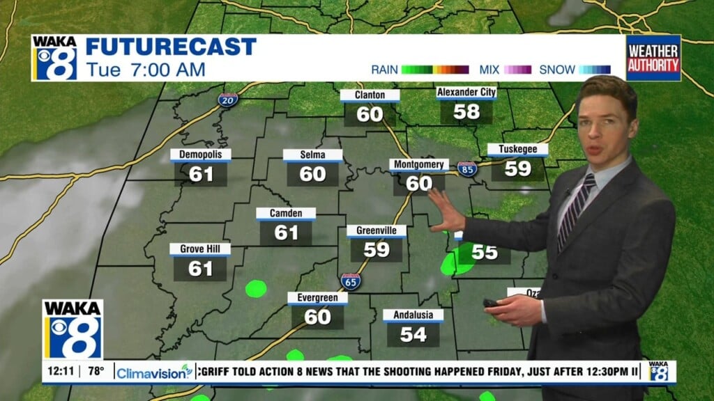
An upper-ridge remains in control of our weather holds in place across the Deep South all week, which will cause afternoon highs to climb into the mid-90s for many locations, which will be close to records for this time of year. We will be looking for heat relief in the form of showers and storms, but with sinking air due to ridge and limited moisture levels, these will not materialize over Alabama. Wit the air being relatively dry, though days are very hot, nights will be fair and comfortable with lows in the 60s.
RAIN CHANCES RETURN FOR WEEKEND: The ridge will begin to weaken by the end of the workweek that may allow a surface boundary to move into the northern parts of Alabama on Friday. There will be a mix of sun and clouds with a small chance of a few isolated to scattered afternoon showers and storms for locations along and north of the I-20 corridor. This boundary will slowly sink south through the state allowing for isolated to scattered afternoon showers and storms statewide Saturday, Sunday and Monday. Temperatures will be a tad cooler with highs closer to the 90° mark during the afternoons.
IN THE TROPICS: We had our first named system of the year as Ana formed, but as of late Sunday night, Ana had become post-tropical and is not longer a tropical system. Across the rest of the Atlantic Basin, tropical cyclone development is not expected the next five days.
Stay cool this week!!!
Ryan