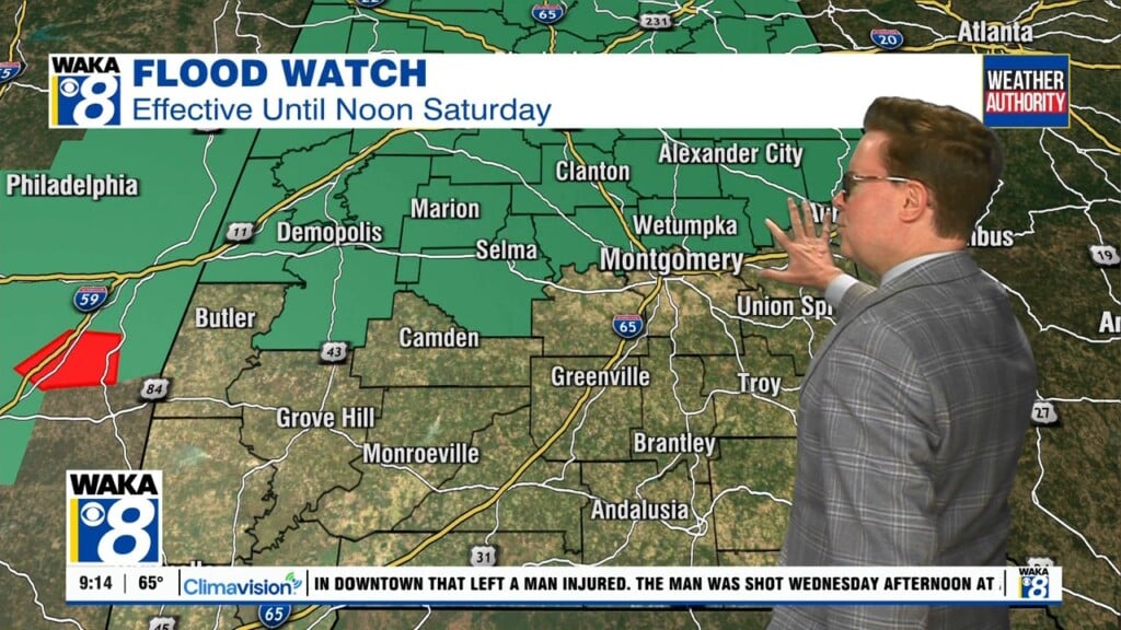
Flooding, Tornadoes Possible From Tropical Storm
A calm and partly cloudy day across Central and South Alabama, ahead of “Potential Tropical Cyclone 3,” before it makes landfall in Louisiana and begins it’s trek through Louisiana, Mississippi, and eventually Alabama. The National Hurricane Center notes they do not expect much more development or rapid intensification. As of right now, PTC3 is very lopsided to the east, with extremely heavy rain expected in the Southeast as it makes landfall. Closer to home, since Montgomery and surrounding areas are to the east of the axis of circulation, tornadoes could be an issue, but often times these tornadoes are very brief and not too intense. Overall, any kind of wind damage associated with this storm, coupled with heavy rain, could cause an issue with loose soil and falling trees. The NHC states the earliest reasonable time of arrival for tropical storm force winds would be around 8am Saturday, but most likely in the afternoon Saturday.
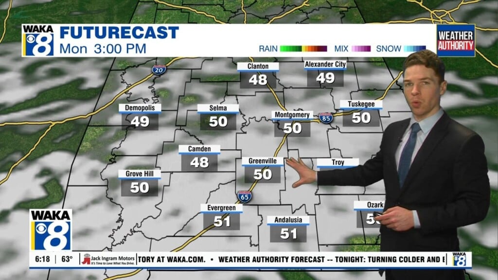
Following this tropical system, rain chances begin to decrease slightly throughout the work week, but rain is still expected, with temperatures steadily trending upward, closer towards average.