Warmer weather through Wednesday, then winter cold returns
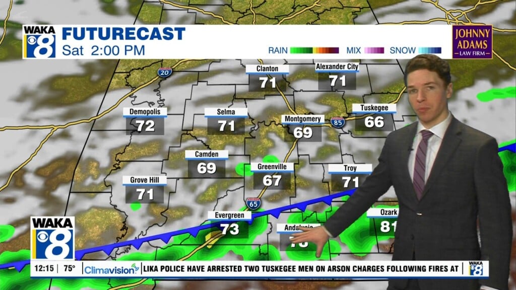
Saturday was a warmer day across central and south Alabama, despite cool morning temperatures and cloud-cover. Highs were in the upper 60s to low 70s in most locations. Winds were out of the east at 5 to 10 mph with higher gusts. Winds remain easterly at a similar speed for the rest of the weekend. Saturday night remains mostly cloudy and warmer, with lows in the low 50s.
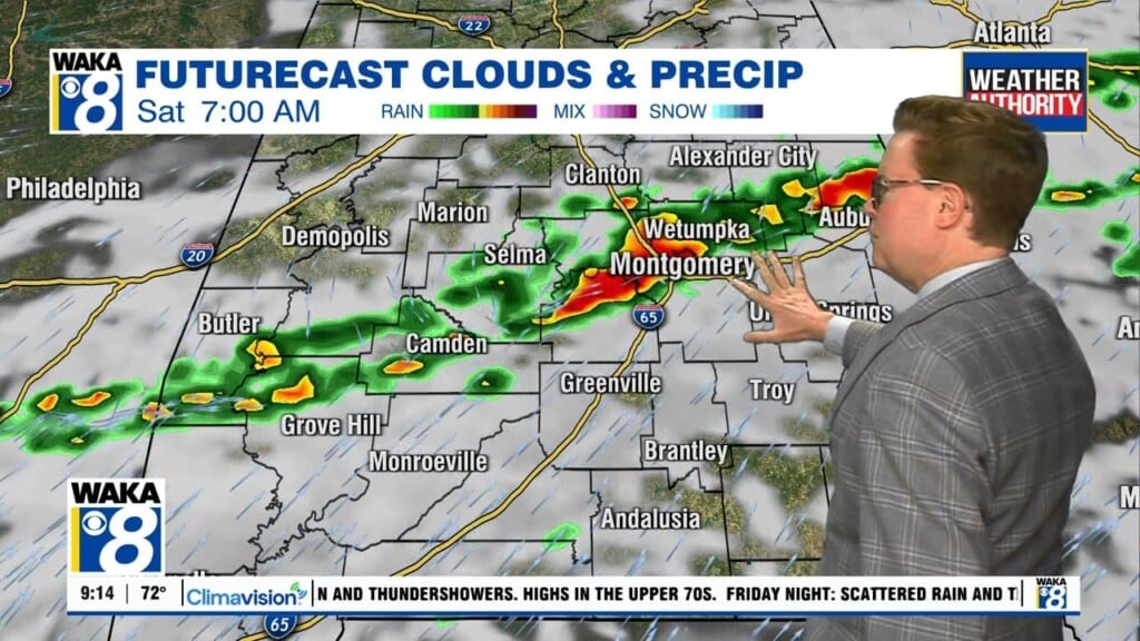
Sunday looks partly to mostly cloudy and mild, with highs in the 60s. Sunday night lows range from the upper 40s to low 50s. The start of next week looks warm for mid-December. High temperatures soar into the low 70s Monday and Tuesday. Each day looks fairly sunny and mainly dry. A cold front arrives Wednesday. At least scattered showers move through our area during the day.
Cold winter air returns behind the front Wednesday night. High temperatures range from the upper 50s to low 60s Thursday and Friday despite sunshine. Low temperatures fall into the 30s each night. Cold weather continues into next weekend. Next Saturday marks the winter solstice, the official start of winter. Looks like high temperatures remain in the 50s Saturday and Sunday, with lows in the 30s.