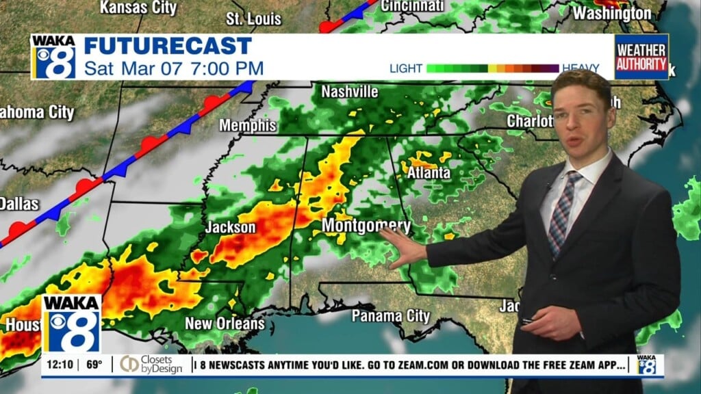
Rain may transition to snow early Sunday in far southeast Alabama
Saturday was a gloomy day, with a mainly cloudy sky and showers at times. Temperatures only warmed into the 50s. Saturday night’s weather becomes interesting, especially south of Interstate 85 and east of Interstate 65. There, rain may transition to a rain/snow mix or all snow late Saturday night. The best chance for snow, including minor accumulations of around 1/2 inch or less on elevated/grassy surfaces looks near and southeast of US-29.
A winter weather advisory includes Pike county from 3AM to 12PM Sunday, but the main window for winter weather likely falls between 3 and 7AM. After sunrise, temperatures rise above freezing, with sunshine throughout the day. Temperatures remain cold, but well above freezing, in the 40s Sunday afternoon. That melts anything frozen, and dries the roads. Sunday night looks very cold, with lows in the low 20s early MLK day morning.