The Cold Air Just Keeps On Coming
The cold air doesn’t want to let up much through the rest of this week. The Arctic air mass in place will slowly release it’s grip on the deep south late week. You should enjoy highs in the 50s Thursday because we’re expecting another Arctic blast blowing in here over the weekend. Temps could plunge into the mid to upper teens by Sunday morning.
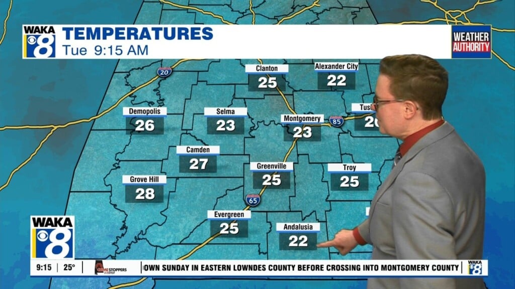
In the meantime, high clouds will move over us tonight. Temps will drop into the mid to upper 20s for lows early Wednesday morning. We’re into a mainly sunny sky and temps do warm a tad more Wednesday afternoon. Most spots should reach the mid to upper 40s for highs. More clouds will roll in Thursday and our sky becomes partly sunny. Temps will climb a bit more and we’re hovering in the lower 50s for afternoon highs.
Looks like a disturbance will head towards the state early Friday. This system may bring in some rain with it. Temps are cold that morning and there could be a brief wintry precipitation threat. Just something we’re keeping an eye on for now.
The weekend is looking rather cold with another Arctic blast of colder air invading the region. Temps will plunge into the teen’s and 20s for lows and highs only managing the 30s to around 40 degrees Saturday and Sunday.