Cold and windy Monday; Trending warmer and mainly dry this week
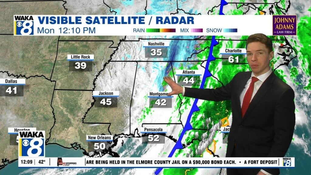
Severe storms rolled through central and south Alabama early Monday morning, but were mostly east of our area at sunrise. A cold front pushed through our area immediately behind the storms. Temperatures dropped quickly, with strong winds on the backside of the front. The sky was still mainly cloudy at midday, with a narrow band of light rain still working west to east through our area. Some sunshine may return Monday afternoon, but temperatures likely remain in the 40s.
A freeze warning covers all of central and south Alabama Monday night. Temperatures fall into the mid and upper 20s. Meanwhile, a bit of a northwest breeze continues overnight, resulting in lower wind chill values. Otherwise, the sky becomes mainly clear Monday night. Tuesday remains cool with highs in the 50s despite a partly to mostly sunny sky. Tuesday night lows fall to near or below freezing (32°).
Temperatures trend warmer for the rest of the week. High temperatures range from the low to mid 60s Wednesday with lows in the upper 30s to low 40s. Temperatures warm into the low 70s Thursday, and to near 80° Friday. Our area likely remains dry for the rest of the week, with a partly to mostly sunny sky each day.
Click here for more weather updates.