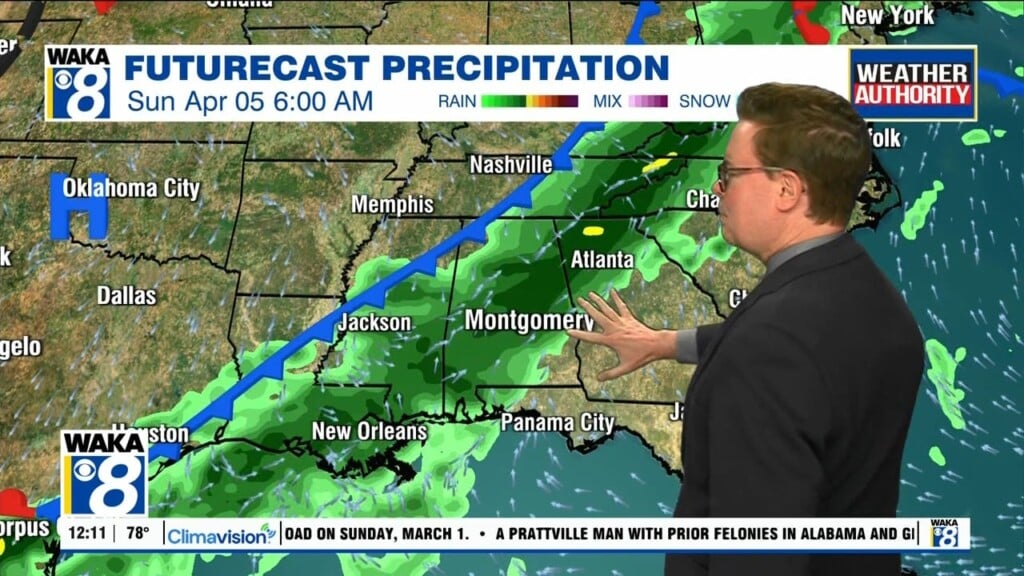
Wet For Part Of Your Easter Weekend
Summer-like warmth will linger into the first half of our weekend. Temps will manage the mid to upper 80s for highs Saturday. A decent area of rain and t-storms will work across the state Sunday. Dry and cooler air will follow in behind the frontal passage.
The frontal boundary moves into the state late Saturday night and advances eastward through the area Sunday. Looks like rain and thunder will be around for your Easter Sunday. Rainfall potential will range between .50 to 1.50 inch. At this point, we don’t see anything other than a few strong storms. The main threat will be gusty winds.
We’re on the backside of the frontal boundary Monday. All indications are we trend a bit cooler through the midweek. Daytime highs will top out in the lower to mid 70s while overnight lows will be in the mid to upper 40s.