Calm Weather Today; Strong/Severe Storms Tomorrow
MONDAY: Some clouds will be passing through this Monday morning, but will give way to mostly clear skies this afternoon! Highs will be in the low 80s across much of the area. For tonight, lows will be in the upper 50s with partly cloudy skies.
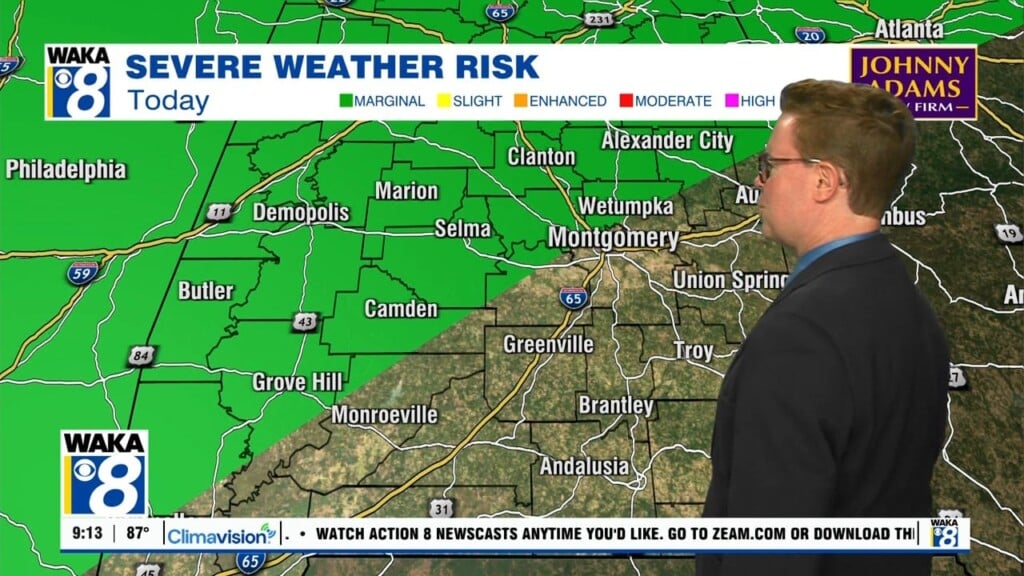
TUESDAY: Strong to severe storms will be back in the forecast Tuesday. So far, a 2/5 SLIGHT RISK is in place for areas Montgomery westward. The main threat will be damaging wind gusts, but some isolated tornadoes are possible as the line pushes through the area. Model examination shows the tornado threat remains fairly low, and likely to our west and southward. Our in house Futurecast Model has the stronger parts of the system to our north, but nothing is quite keying in on our area receiving the heaviest of the system. Highs will be in the upper 70s and low 80s.
WEEK AHEAD: After tomorrow’s system moves through, our weather becomes fairly calm through the remainder of the week! Temperatures will not be impacted too much, as highs will remain in the mid 70s through the rest of the week.