Winter Not Going Away Quietly
Spring officially begins tomorrow but winter doesn’t want to leave us just yet. A surge of much colder air is spilling into the state and it will lead to the potential for widespread Tuesday. Fortunately it’s just a one night event and the rest of the week will be trending a bit milder.
In the meantime, clear skies and much colder air are on tap for tonight. Temps will plunge into the lower to mid 30s for lows. Widespread frost potential is likely so take care of those tender plants and make sure the pets have a warm place to stay. We quickly thaw out as temps manage the lower to mid 60s Tuesday afternoon. Temps will continue to climb through the week and highs will be in the 70s as early as Wednesday afternoon. Morning temps will head into the 40s and 50s as the week progresses.
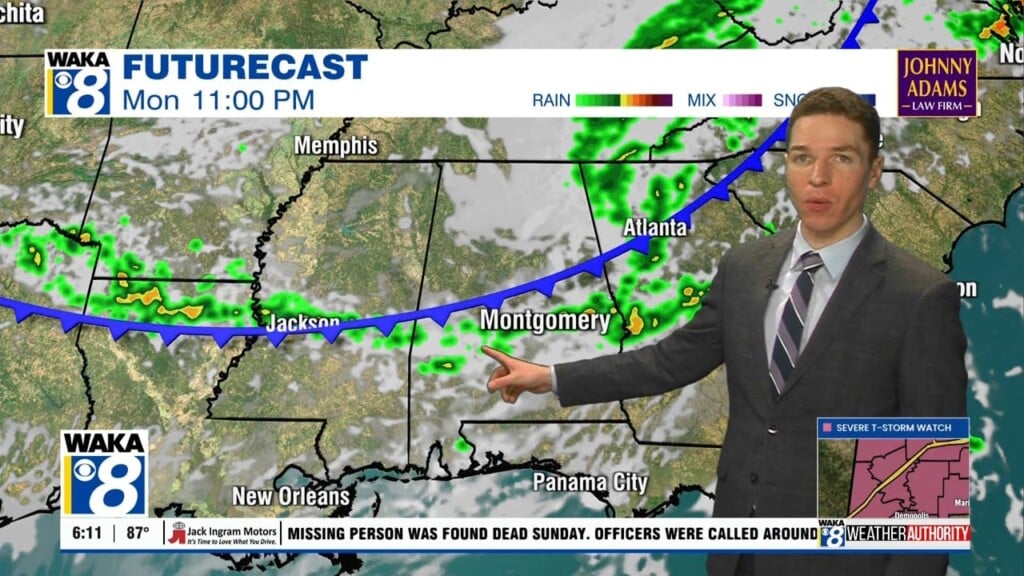
Our next weather maker will be an area of low pressure moving across the Gulf of Mexico later in the week. It’s track will bring in clouds and rain for us. Anything stronger will stay well to our south. We don’t even see this system being a significant rain threat either. The lows northern fringes will basically graze us. The system will move eastward over the Florida peninsula and be a much bigger deal for those folks. Meanwhile, it’s setting up to be a dry weekend around here. We could see upper 60s to lower 70s for highs under mainly sunny skies.