ACTION 8 WEATHER AUTHORITY: Severe storm threat Sunday night, early Monday

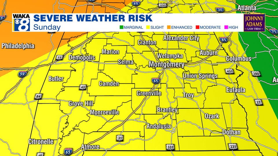
ACTION 8 WEATHER AUTHORITY: The entire Action 8 viewing area is in a Slight Risk area (level 2 out of 5) for severe weather Sunday night through early Monday morning.
Storms will be capable of bringing damaging winds, hail and even a few tornadoes. You will need to be weather aware during the overnight hours Sunday through early Monday morning.
While all of our area is under a Slight Risk, there is an Enhanced Risk (level 3 out of 5) in the north and northwest part of the state, including Huntsville, Decatur and the Shoals.

Now is the time to prepare. First, download the free Action 8 weather app:
iPhone – Android
Next, make sure you have more than one way to get weather alerts. A NOAA weather radio in addition to your phone (with your emergency alerts turned on) make for a good combination. Do not depend on sirens to keep you protected.
Know where to go inside your home if severe weather is imminent. If you live in a mobile home, you need to find sturdy shelter somewhere else. Plan now for what you will do.
Action 8 News will bring you live coverage on-air, online and on your phone. We will be staffed around the clock until the severe weather threat passes.
Watches & Warnings
Live Interactive Radar
Exclusive WeatherSTEM – live conditions in Montgomery
Weather Authority: Twitter – Facebook
Weather Authority Web Page
Safe from the Storm – storm safety tips
Severe weather coverage on Action 8 News is sponsored by the Johnny Adams Law Firm.