After Ida Exits, Routine Weather Returns
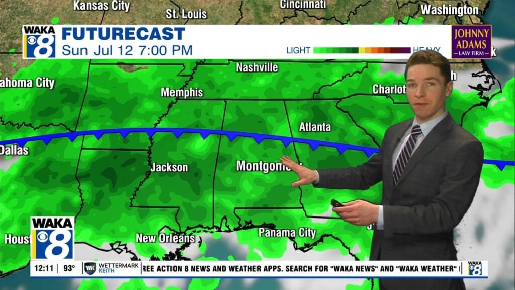
Hurricane Ida made landfall in southeastern Louisiana earlier today, which brought extreme winds and heavy rain to New Orleans and surrounding areas. For us, rain bands have been moving through throughout the day, bringing heavy rain and gusty winds for now. The chance for spin-up, isolated tornadoes will be continuously monitored throughout the day and evening, and this threat will persist for several days as Hurricane Ida moves farther inland.
TONIGHT: The threat for heavy rain, gusty winds, and spin-up tornadoes still exist throughout the night as the eastern rain bands from Hurricane Ida begin to move their way into our area. Expect lows in the low to mid 70s.
TOMORROW: The effects of Hurricane Ida will be slightly more amplified as the main circulation of Ida begins to move inland along the Mississippi River. The threat for heavy rain, strong wind gusts, and isolated tornadoes will be slightly more elevated during this time. The time frame seems to be an all day and night type of event, so be prepared whenever a warning is issued. Wind gusts could be in excess of 40 mph, as well as the threat for heavy rain and potential flooding. Parts east of I-65 could between 3-6 inches of rain, with some spots potentially seeing higher amounts.
8 DAY: Monday-Tuesday will be an active day weather wise as Hurricane Ida moves farther inland and rain bands begin to broaden. The chance for heavy rain, gusty winds, and isolated tornadoes will exist the entirety of Monday and up until about midday Tuesday. After Ida’s departure, things will return back to normal, as temperatures will begin to rebound back towards the 90s and afternoon rain chances persist.