Hot, Humid, Daily Storms
BACK TO WORK: Similar weather setup today to what we saw yesterday; a weak frontal boundary is stalled across Central Alabama, closer to the Interstate 85 corridor. We are starting the day off dry, but with the front being a focal point for uplift, we are once again going to see showers and storms this afternoon, but also once again, mainly south of the Interstate 20 corridor. It will be another day with a mix of sun an clouds and highs will be around the 90 degree mark.
THE WEEK AHEAD: Hot weather will be the word through much of the coming week, with scattered showers and storms each afternoon and evening, driven by daytime heating. It is going to remain hot as an upper level ridge builds across the Southeast U.S. into the end of the week. The GFS continues to come in weaker with the strength of the ridge, so we probably won’t see temperatures higher than the lower 90s. Overall, a standard week of summer weather is expected. However, there will be a threat of rain each day.
TROPICAL UPDATE: Still watching a couple of areas of unsettled weather in the tropics. Area one is a low pressure system located about 1000 miles east of the Leeward Islands is producing a large area of cloudiness and showers. Shower activity associated with this system has increased slightly, and a tropical depression is likely to form later today or on Monday before upper-level winds become less conducive for development. The low is expected to move northwestward or north-northwestward at 10 to 15 mph over the central Atlantic Ocean during the next few days. Feature two is showers and thunderstorms continue in association with a disturbance near the central and southeastern Bahamas. However, surface pressures are high, and there are still no signs of a surface circulation. Conditions do not appear conducive for significant development of this disturbance while it moves west-northwestward at 10 to 15 mph. Locally heavy rainfall is possible over portions of the Bahamas today and on Monday, and these rains are likely to spread over portions of the Florida peninsula by Tuesday.
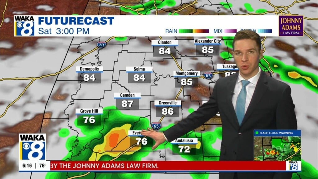
THE ALABAMA WEEKEND: By next weekend, showers/storms area expected to become more numerous as the surface high shifts east and brings our surface flow around to the south. The increased moisture along with a a deep trough developing over the eastern U.S. and an approaching cold front on Sunday should bring up our chances for rain, and we really need some rain. With the better rain chances and more clouds, temperatures will be back into the 80s for highs.
WEATHER ON THIS DATE IN 1979: Hurricane Frederick smashed into the Mobile Bay area of Alabama packing 132 mph winds. Winds gusts to 145 mph were reported as the eye of the hurricane moved over Dauphin Island AL, just west of Mobile. Frederick produced a fifteen foot storm surge near the mouth of Mobile Bay. The hurricane was the costliest in U.S. history causing 2.3 billion dollars damage.
Be sure to stay connected throughout the day and night follow me on twitter: @Ryan_Stinnett and Like my Facebook Fan Page “Meteorologist Ryan Stinnett.” Have a great day!