Calm Tuesday, Severe Weather Again Wednesday
Calmer weather today. We are starting the day off with some dense morning fog, but overall, today will be a very nice and warm day as we wait on the next round of storms Wednesday. We are forecasting a day with a mainly sunny sky and highs in the lower and mid 80s. No issues during the daylight hours, but we note much of Alabama has been highlighted in a threat for severe weather for overnight tonight.

In the latest day one convective outlook, the SPC has the standard “slight risk” for severe storms for much of Alabama, including the cities of Tuscaloosa, Montgomery, Mobile, Birmingham, and Selma. Again the day will be fine, this threat is for the overnight hours as a warm front lifts north, and a few strong and possibly severe storms are likely to develop after midnight into Wednesday.
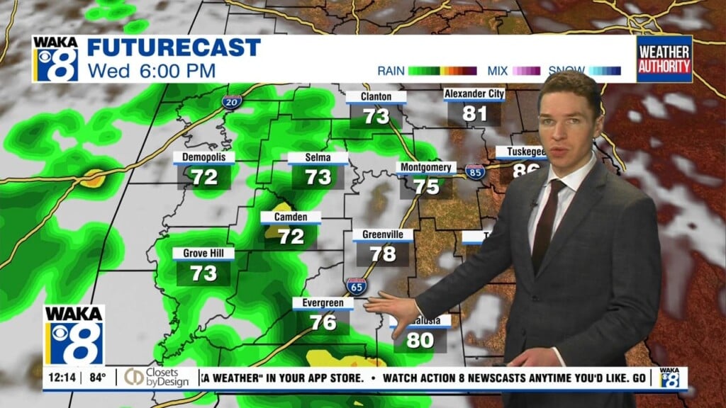
MORE SEVERE STORMS: Our next storm system arrives tomorrow, and will bring the threat of strong to severe storms to Alabama. Much of Alabama is already under a risk for severe storms Wednesday where the SPC has already defined a “moderate risk” (level 4 out of 5) of severe storms across Southeast Alabama. This is where the highest threat of severe storms will occur during the afternoon. Much of the rest of the state is highlighted in an “enhanced risk” (level 3 out of 5) for severe storms, so the entire state could see severe storms.

We are going to have to deal with those overnight and early morning storms Wednesday, but these storms should be elevated, however, they could still bring the possibility of hail and strong winds. After these storms track north of the area with warm front, we are going to be watching of new storms Wednesday afternoon.
The environment will become very favorable for severe weather over Alabama during the day, as surface based instability values are forecast to soar into the 2500-3500 J/kg range, with fairly robust bulk shear values as well. Storms that form during the afternoon and evening hours will have the potential to produce large hail, damaging winds, and a few tornadoes, perhaps even a few strong tornadoes. Hopefully the morning storms will somewhat reduce the severe threat Wednesday afternoon, but that remains to be seen. We will have a much better look at the setup as we head through the day tomorrow.
LATE SEASON COLD SNAP: An area of high pressure builds in under an upper-level trough and the end of the week and into next week, looks to feature very nice, but cooler weather. Thursday will be breezy and much cooler with a gradually clearing sky, and temperatures in the 60s. Sunshine will return in full supply Friday, with highs in mid 60s, however, Friday and Saturday mornings, are going to be cold, with lows perhaps in the 30s.
REST OF WEEKEND: After the chilly start to Saturday, the afternoon and into Sunday will be very nice with ample sunshine and highs returning to the 70s as well. A very nice weekend for sure and the weather will be great for the Air Show at Maxwell Air Force Base! Rain and storms do not look to return to the forecast until the middle of next week.
Have a great day!
Ryan