Winter Temperatures are Back to End the Work Week
High pressure will be firmly in control of our weather, both today and tomorrow will feature tons of sunshine, but chilly temperatures. It will remain breezy today making it feel colder as well. Highs this afternoon will struggle to climb into the 50s for many locations, while Friday highs should return to the upper 50s. Tomorrow morning will be the coldest as we start the day in the upper 20s and lower 30s across much of South/Central Alabama.
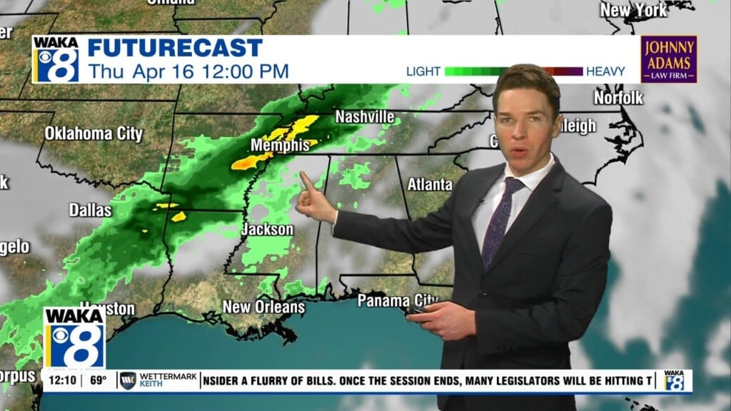
WEEKEND WEATHER: Saturday will be dry with a partly sunny sky and highs near 65°. Clouds will be on the increase late Saturday as our next storm system approaches from the west. Rain and some storms are expected back in Alabama Saturday night and in Sunday. The rain will come to an end by Sunday afternoon with drier air returning to the state. Of course, any system this time of year has to be watched for the threat of severe storms, but for now, the Sunday system still doesn’t appear to be a severe weather setup, of course that can chance in the coming days, so we will be watching. Sunday’s high should be close to 70° for most places.
HELLO FEBRUARY: The new month looks to start off quiet for early next wee…expect seasonal temperatures; highs in the 50s and 60s and lows in the 30s. Next chance of rain will likely come after midweek on Thursday or Friday.
Have a Thursday unlike any other!!!
Ryan