Sun-Filled Wednesday of Weather
Another splendid spring-like day of weather highlights our forecast for today. It was a chilly start to the day with 30s and 40s, but under a sky full of sunshine, temperatures are surging into the mid and upper 70s for the afternoon.
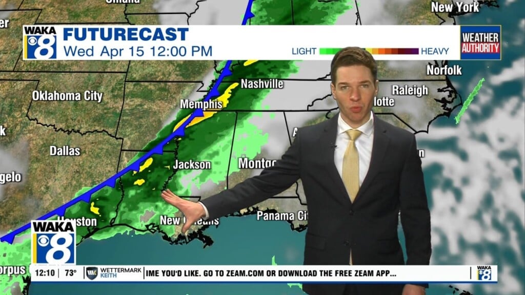
APPROACHING FRONT: A weak front will sink into the state from the north overnight, which will allow for clouds and the chance for a few isolated showers tonight, but nothing heavy or widespread, and most locations will stay dry. Highs tomorrow will be in the low 70s. Rain looks to become more widespread across the state Thursday night and Friday as the front stalls and a wave of energy moves through the state. There could be a rumble of thunder in spots, but no severe storms are expected, and the best chance of rain will be over the northern half of the state. Highs Friday will be in the upper 60 for the southern half of the state.
WEEKEND WEATHER: With the front meandering about the state, we are going to leave the chance for scattered showers in the forecast both days this weekend. For now, it looks like the front will be across the Tennessee Valley, so that is where the better chances for rain will be this weekend, but for much of the area, the weekend will feature more clouds than sunshine, with scattered showers possible at times, but by no means, a weekend “wash-out”. With the front north of the area, temperatures should be fairly mild with highs in the mid to upper 70s both days.
ROLLING INTO MARCH: Not much change in the pattern for as we roll into next week, and with the front meandering about, we will keep a forecast featuring more clouds than sunshine and showers possible at just about anytime most days. Temperature should remain mild with highs generally in the 60s and 70s. No signs of Arctic air returning to the Deep South or any other high impact event for the the state the next seven days.
Enjoy this Wonderful Wednesday of Weather!!!
Ryan