Multiple Rounds of Severe Storms Possible Friday and Saturday
STRONG STORMS ON THE WAY: A warm front is lifting north across the state today, bringing an unstable air mass back to Alabama, and occasional rain and storms will highlight the forecast for today, especially during the afternoon and evening hours. Where these pulse-like storms form they could be strong, and could become severe and the SPC has defined an “enhanced risk” (level 3/5) of severe storms for a much of West Alabama, with the “slight risk” (level 2/5) for the rest of the state until 7AM Saturday.

The main threat from these storms will be large hail and damaging wind gusts, pretty typical of what we see on a summer day in Alabama. We also note, the “moderate risk” (level 4/5) across Mississippi, which is for clusters of storms which develop later today and will push into Alabama overnight tonight and impact our Saturday morning forecast.
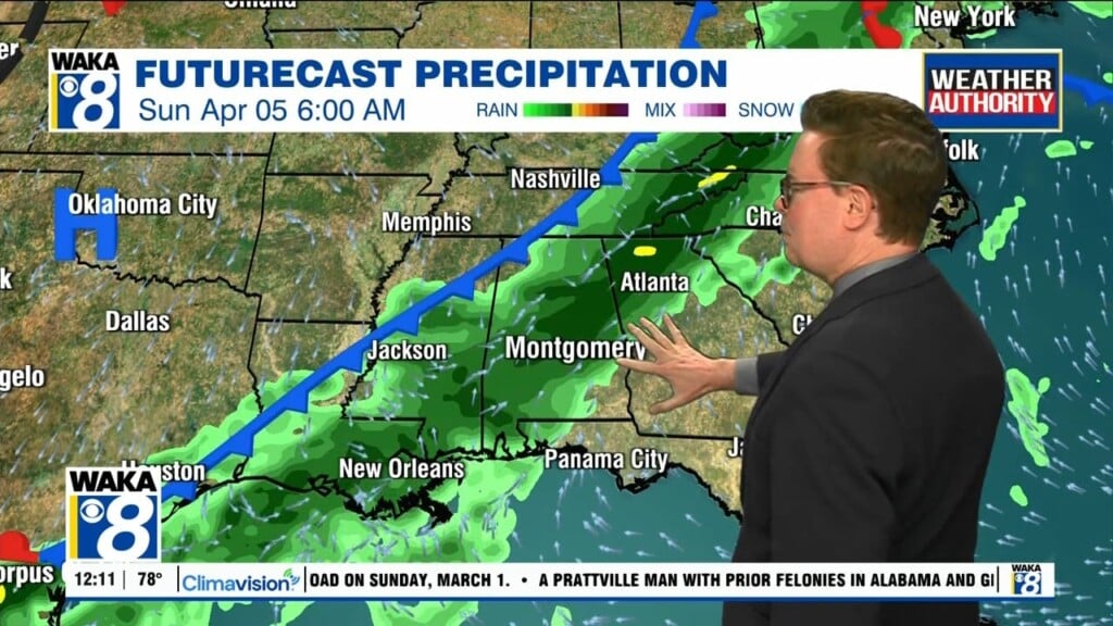
We will be watching these storms as the move across the Mississippi Valley later today. These cluster of storms will be pushing rapidly east across Alabama during the early morning hours Saturday and will be capable of producing large hail and a few tornadoes are possible, but the main threat will be damaging winds, perhaps over 70 mph, which could produce widespread damage Saturday morning…So be prepared!!!
From 7AM to noon Saturday, the SPC has much of Alabama again in a Level 2/5 for severe storms for this threat.

The storm threat winds down by the midday hour, and Saturday afternoon looks dry with highs in the 70s.
Rainfall totals between now and midday tomorrow will be in the 1-3 inch range across the state, so some isolated flooding is possible, but of course the main concern will continue to be numerous rivers across the state, which continue to run full from recent rains.
Sunday looks mostly rain-free statewide with a mostly sunny sky. Highs Sunday afternoon will be in the mid 70s.
NEXT WEEK: The dry weather continues for Monday and likely Tuesday, by Wednesday and Thursday clouds return and some showers are possible, but for now this doesn’t look like a widespread event and severe weather looks unlikely. Temperatures will remain warm with 70s and 80s expected most afternoons.
Stay weather aware!!!
Ryan