Dry Week Ahead, before Rain Returns Saturday
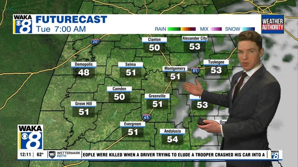
QUIET START TO WEEK: Today and tomorrow’s weather will be rather similar with dry conditions and a mostly sunny sky today followed by a partly sunny one on Tuesday. Highs this afternoon will reach the mid-70s. Tuesday will see highs in the upper 70s.
MIDWEEK FRONT: Wednesday will be another dry day, but the passage of a cold front will keep temperatures cooler, and it will be quite breezy at times. Highs will range from the mid to upper 60s. Wednesday night/Thursday morning will be chilly with lows near 40°, and there could be some upper 30s. Thursday will feature plenty of sunshine and highs near 70°.
FRIDAY & THE WEEKEND: On Friday, a surface low will be getting its act together off to our west and will be moving eastward. That will bring clouds to the area throughout the day, but most of us should remain dry with highs in the 70s. The low will continue to move eastward and will skirt by just to the north of the state. There will be some instability involved as the system moves through the area that will make rain and storms likely throughout the day, with the potential of a couple of storms becoming strong. We’ll have better details as we get closer to the weekend. Highs will be throughout the 70s across the area. Those storms are well out of the area by sunrise on Sunday morning and skies will be mostly clear throughout the day. It will be a nice day with highs reaching the 70s across the area.
Have a great day!!!
Ryan