Update on Saturday Severe Weather Threat
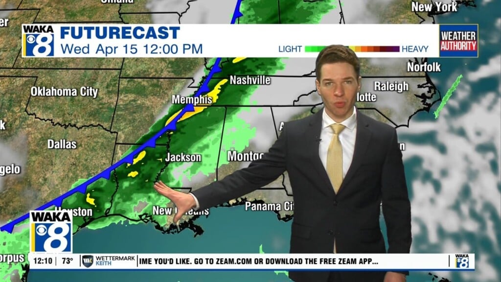
STORMS ON THE WAY: Clouds have been increasing across Alabama today and temperatures this afternoon are approaching the mid 70s for most location. To the west of Alabama, severe weather is developing across ARKLATEX, and that is heading towards Alabama tonight, setting up an a wet and stormy Saturday for the state.
TWO ROUNDS OF STORMS EXPECTED: A dynamic storm system is allowing for severe storms to develop today west of Alabama, and these will organize into a MCS (Mesoscale Convective System) and will move into Alabama later tonight, after midnight this will be round one of two rounds of storms we will deal with over the next 36 hours. Be sure to have multiple, reliable ways to receive severe weather alerts, and be prepared to act if and when watches and warning are issued.
This first round will arrive in Alabama after midnight tonight, and will rapidly push through the state during the pre-dawn and early morning hours tomorrow; main timeframe will be 2AM-9AM. In the new day one convective outlook, which runs until 7AM tomorrow morning, the SPC has much of South Alabama under a “slight risk” (level 2/5) for severe storms, with a “marginal risk” (level 1/5) for areas as far north of a line from Tuscaloosa to Auburn.

This round will produce widespread rain and storms, and the rainfall could be heavy at times, possibly leading to flash flooding issues. These storms will be capable of producing damaging winds, some hail, and some tornadoes, with the great chance of tornadoes across the southern half of the state. By mid-morning this round will be out of the state, and we should see a lull in the activity for several hours.
Round two will occur tomorrow afternoon as the actual front approaches the state. For tomorrow, in the new update from SPC just out, has all of Alabama in a risk for severe weather with much of the state in an “Enhanced Risk” (level 3/5).

Ahead of the front, the air is expected to become unstable due to daytime heating, but also very cold air aloft will move in over the state. Additional showers and storms should develop in this environment and some of these storms could be strong to severe. These storms could produce very large hail (larger than golf balls) due to the cold air aloft and also could produce damaging straight-line winds…the wind profiles become somewhere unidirectional by afternoon, so the tornado threat looks very low tomorrow afternoon. The main timing for these storms looks to 1PM-7PM.
Also, all of the state will see a good soaking, with rain amounts of 1-2 inches likely across North/Central Alabama, while amounts of 3-4 inches are possible down towards the south. Some isolated flooding issues could develop during the day.