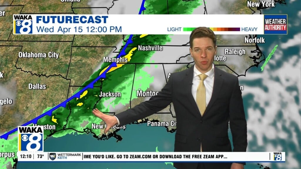
More Severe Storms Possible Through 9PM

Today’s second round of strong to severe storms is expected to continue until 9PM for Central and South Alabama.
Storms will be capable of producing large hail, damaging winds and perhaps some tornadoes.
These storms are more scattered in nature and will develop ahead of the cold front approaching the state. Ahead of the front, the air is expected to become unstable due to daytime heating, but also very cold air aloft will move in over the state.
These storms could produce very large hail (larger than golf balls) due to the cold air aloft and also could produce damaging straight-line winds, the wind profiles become somewhere unidirectional, so the tornado threat is low, but not zero.
Also, heavy rain has already fallen this morning, and another 1-2 inches is likely so some isolated flooding issues could develop during the day. Be sure to have multiple, reliable ways to receive severe weather alerts, and be prepared to act if and when watches and warning are issued and stay weather aware today.
SUNNY SUNDAY: The rain and storms will end by late tonight as dry air returns to Alabama and Sunday looks like a nice day with a good supply of sunshine, and highs in the 70s.
Watches & Warnings
Live Interactive Radar
Exclusive WeatherSTEM – live conditions in Montgomery
Weather Authority: Twitter – Facebook
Weather Authority Web Page
Safe from the Storm – storm safety tips