Another Hot August Day, Along With Fred Regaining Strength
TODAY: It has been a very hot day today, with most places in the mid 90s, with heat indices exceeding 100, and some places nearing the 105 degree “danger range,” which is near the level when outdoor activity needs to be limited. Radar has begun to get active in these afternoon hours, with showers developing in East Alabama and propagating westward. Some of these storms could produce torrential rainfall and frequent lightning. These storms are NOT associated with the remnants of Fred.
TONIGHT: Once the showers clear out, clouds will linger throughout the night. This will leave us with mostly cloudy skies throughout the night, with muggy feeling conditions. Lows will be in the low to mid 70s.
TOMORROW: Rain chances will be on the increase tomorrow, especially in the afternoon. This will be associated with the typical afternoon summer weather pattern. These storms will remain mostly isolated in nature, but some could be on the stronger side; the main threats being heavy rain and frequent lightning. Highs will be in the upper 80s, with some places seeing 90s.
8 DAY: Showers and storms are expected tomorrow, with lower temperatures ahead of Tropical Storm Fred’s arrival. Monday will be relatively calm but overall cloudy. The National Hurricane Center has slowed down Fred’s landfall and is expecting a Monday night/Tuesday morning landfall. After landfall, local impacts should be expected, even at tropical storm strength. Past Wednesday, rain chances remain in the afternoon headed towards the weekend, with temperatures rebounding back into the upper 80s and low 90s.
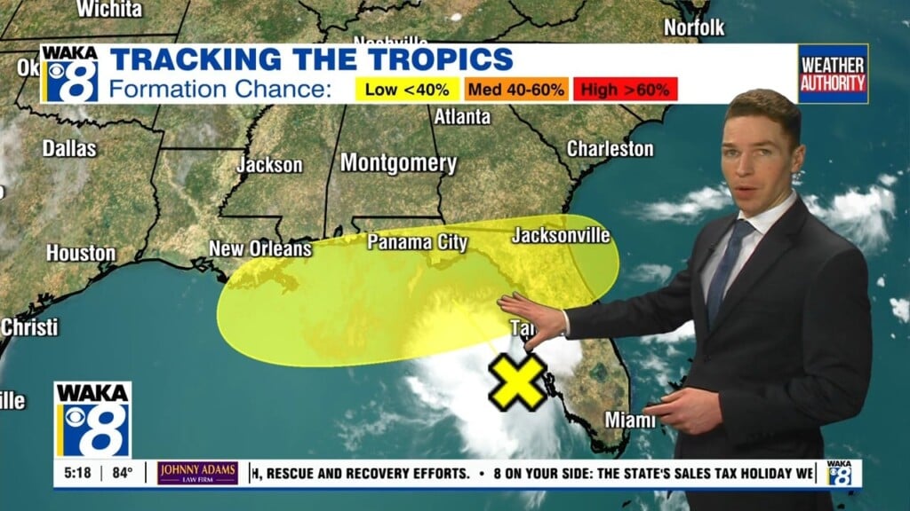
FRED: Alabama News Network is tracking the remnants of Fred, which are expected to strengthen. The track of the storm has shifted westward, putting Montgomery in the stronger eastern side of the circulation once the storm makes landfall.
The National Hurricane Center says watches may need to be issued for the Alabama coast later in the weekend.
While Fred is currently disorganized, the storm is expected to pass west of the lower Florida Keys this afternoon, move across the eastern Gulf of Mexico tonight through Monday, and move inland over
the northern Gulf coast Monday night.
Maximum sustained winds are near 35 mph with higher gusts. Fred is expected to re-develop into a tropical depression on Sunday, with gradual strengthening to a tropical storm expected after the system re-develops.
Despite the uncertainty, you should be prepared for Fred to affect Alabama in the coming days. As always, the side that is to the right of the center of circulation is where you can expect the majority of the impact to occur. On the latest track, Montgomery is now on that eastern side.
Local impacts to expect will be: torrential rainfall, strong winds, high wind gusts, and the possibility for brief, spin up tornadoes.
Stay with the Alabama News Network Weather Authority for updates.