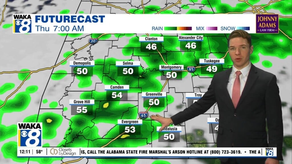
More Above Average Warmth Ahead
We continue with the chance for occasional showers and possibly t-storms this week. A frontal boundary will hover over us through mid week. It will be the focal point for showers and possibly t-storms through Wednesday. Rainfall potential will range between .25 to .50. Slow moving showers or storms could drop much more in spots. High temps will be down in the lower 80s due to clouds and shower activity Wednesday. We’re back into the mid to upper 80s for highs Thursday into the upcoming weekend. We expect high pressure to build down into the area Friday. This weather feature will help provide lots of sunshine and keep us dry. We could even say there will be a summer-like feel with temps topping out around 90 degrees for several days.