Trending Slightly Cooler Late Week
We have a frontal passage underway and we’re on the backside of it for the remainder of the week. The winds switch around to the north and surge of cooler air moves into the area. Temps will trend a little cooler for a few days but more spring-like warmth is coming back soon.
In the meantime, our sky will become partly cloudy and temps will fall into the upper 30s to lower 40s overnight. That front boundary pushes farther south of us and we’re in between weather systems Thursday and Friday. We’re expecting lots of sunshine and temps to top out in the upper 60s to around 70 degrees.
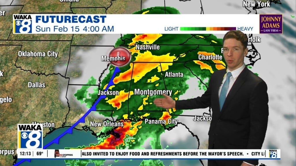
Our rain chances will increase over the upcoming weekend. A frontal system will approach from the west and be the focal point for rain and possibly t-storms late Saturday into Sunday. An area of low pressure will develop and move the boundary through the state. Rain is likely and there will probably be t-storms passing through here as well. Right now, we don’t see anything too strong or severe but we are watching for any signals as we get closer to the weekend. Temps will continue to reach the 70s for highs both days.
High pressure will build over the deep south early next week. This should provide us with a sunny sky and more warm temps. Looks like no bitter cold air in sight and more of that 70+ degree warmth .