Cooler, sunshine through Friday; Rain, some thunder this weekend
Thursday morning was cooler thanks to the cold front that pushed through central and south Alabama on Wednesday. Morning lows ranged from the upper 30s north to mid 40s south. However, temperatures were back in the low to mid 60s at midday. Sunshine remains abundant with high temperatures in the mid to upper 60s Thursday afternoon. Thursday night looks mostly clear and cool with lows in the upper 30s to low 40s.
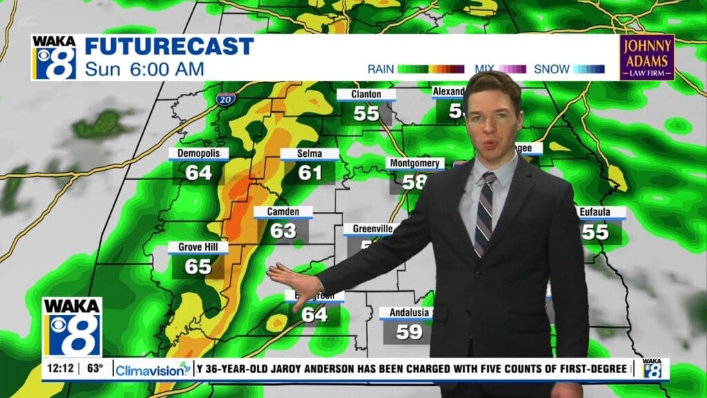
Friday looks mostly sunny with highs near 70°. Friday night looks cool with lows in the low to mid 40s. Clouds increase Saturday, with showers possible towards Saturday night. However, rain coverage likely remains isolated to widely scattered late Saturday. Despite clouds and perhaps some rain, temperatures still warm into the low 70s Saturday afternoon. Rain and some thunder looks more likely Sunday as a cold front approaches Alabama.
Due to limited instability, the risk for strong to severe storms looks very low across central and south Alabama Sunday. However, locally heavy rain appears possible, with rain totals in some locations potentially greater than one inch. Temperatures may still warm to near 70° despite clouds and rain Sunday. Our area trends drier Sunday night as the weekend weather system pushes through and east of our area.