Cooler, windy Thursday; Mainly dry, warmer through this weekend
Showers and strong to severe storms were long gone by midday Thursday. At that point, the sky was mostly sunny across central and south Alabama. The sky remains mainly sunny Thursday afternoon. However, temperatures remain a good 20 to 25° degrees cooler than Wednesday, with highs in the low to mid 60s. Meanwhile, winds remain strong out of the northwest at 15 to 20 mph with gusts to around 30 through the afternoon.
Temperatures fall into the 30s Thursday night. However, Friday trends warmer with a mainly sunny sky. High temperatures range from the upper 60s to low 70s. The weekend looks even warmer and mainly dry. Temperatures warm to either side of 80° Saturday and Sunday. Saturday looks mostly sunny and dry. Sunday looks partly cloudy with stray showers possible during the day.
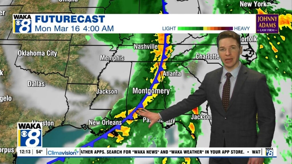
However, the warmer weather only lasts a short time this time. Another cold front arrives Sunday night. Showers, perhaps occasional thunder looks more likely along the front. Rain may depart very early Monday morning. Temperatures turn much colder again Monday and Tuesday. High temperatures may only be in the 50s each day with lows in the 30s. However, after that, temperatures trend warmer with mainly dry weather through the end of next week.