Severe storms possible Wednesday night, more rain this weekend
Tuesday was a pleasant spring day across central and south Alabama. Temperatures fell into the low 50s and even 40s in some locations at sunrise, but afternoon temperatures warmed into the low 80s. It was also a dry day with sunshine, but chances for rain and storms return soon. Tuesday night remains dry and milder, with lows in the 60s. Low clouds or fog may develop in some locations after midnight.
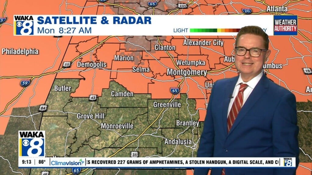
Much of Wednesday looks mainly dry and warm, with the sky becoming partly to mostly sunny during the afternoon. High temperatures range from the mid to upper 80s. Storms return to our area Wednesday night. Some storms may be strong to severe, capable of damaging wind gusts, hail, and at least a couple tornadoes. The storm prediction center now places west-central Alabama within an enhanced (level 3/5) severe risk.
The risk level is lower at slight (level 2/5) and marginal (level 1/5) for most of our area through 7AM Thursday. However, the severe weather hazards remain the same. Beyond 7AM Thursday, a marginal severe risk cover the southeast part of our area. A cold front slowly moves through our area during the day, with more scattered storms developing along and in advance of the front into the afternoon. Damaging wind gusts look like the main hazard Thursday.
The cold front pushes southeast of central and south Alabama by late Thursday afternoon. Some sunshine may return late in the day, with high temperatures in the 70s to around 80°. The sky remains mostly cloudy through Friday. Friday may begin dry, but showers appear possible across far south Alabama by Friday night into Saturday. More showers and storms appear possible Mother’s Day as another cold front swings through Alabama.
Click here for more from WAKA.