Additional showers/storms Monday evening; Drier, less hot Tuesday
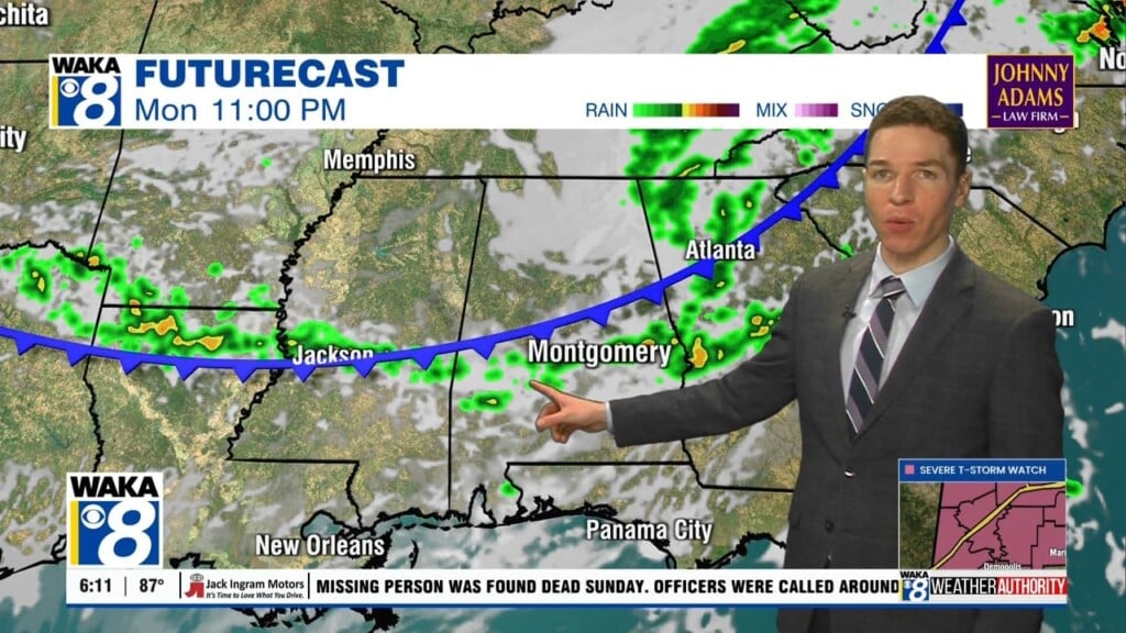
Some showers and storms rumbled across southeast Alabama Monday afternoon. A severe thunderstorm watch was issued for the northwest half of the state earlier in the day. The watch included Marengo and Perry counties in our area until 7PM, but was cancelled early. However, additional showers and storms may develop along a front and track through our area Monday evening/night.
If so, they may be capable of strong wind gusts. The greatest chance for a severe wind gust or two lies on either side of highway 80 and Interstate 85. The storm prediction center places a MARGINAL (level 1/5) severe risk there. Model data suggests storms along the front gradually lose steam as they move into far south Alabama after midnight. After storms pass through any given location, Monday night becomes partly cloudy with lows in the low to mid 70s.
The front moves south of our area early Tuesday. Tuesday looks like a drier and slightly cooler day for our area, with highs near or below 90° despite a fair amount of sunshine. Although, isolated showers or storms may form across far south/southwest Alabama by the afternoon. Tuesday night lows may fall into the 60s. Isolated to widely scattered showers and storms appear possible Wednesday and Thursday, with the best chance for rain across southwest Alabama.
Isolated to widely scattered showers and storms remain possible this weekend. Meanwhile, high temperatures may rise into the mid 90s by Sunday. High temperatures may remain in the mid 90s through the end of June and start of July next week. Although, at least some of our area may receive a cooldown each day from a shower or storm. Rain coverage looks isolated to widely scattered for most of next week at this time.