Chances for rain return through Friday, reasonable afternoon heat
Tuesday’s weather was a bit more quiet after a severe storms downed some trees and caused power outages in the river region late Monday evening. Some showers and storms formed in far south Alabama during the afternoon, mainly near and south of highway 80, but most of our area stayed dry. Meanwhile, temperatures were a bit cooler Tuesday, with highs mostly in the 80s. Tuesday night lows fall into the 60s with a mostly clear sky.
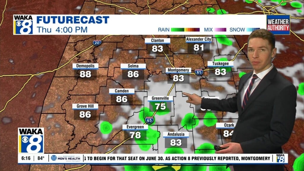
A “cold” front pushed through our area Tuesday. It likely stalls near the north gulf coast Wednesday and fizzles out Thursday. While temperatures remain a bit cooler Wednesday and Thursday, lingering humidity still fuels some showers and storms. Models suggest a disturbance rolls into our area Wednesday. That results in isolated to widely scattered showers and storms during the afternoon. Some rain lingers into the evening and even through Wednesday night.
Otherwise, high temperatures range from the 80s to 90° Wednesday with a partly cloudy sky. Isolated to widely scattered showers and storms cover part of our area throughout Thursday. Otherwise, the sky remains partly to mostly cloudy with high temperatures in the 80s to 90°. Isolated to widely scattered showers and storms remain possible Friday, with high temperatures in the low 90s and a partly cloudy sky otherwise.