Strong to Severe Storms Tonight
STRONG STORMS LATER TODAY: Much of the day will be dry with warm and breezy conditions. Highs today will be in the lower 80s and our winds will be increasing from the south at 15-25 mph. Expect increasing clouds through the day with a band of strong to severe storms moving into the state late in the day.
In the latest severe weather convective outlook, the SPC maintains all of Alabama in a risk for severe weather for today, tonight, and into early Friday morning. For much of South/Central Alabama, there is an “enhanced risk” (level 3/5) for severe storms, while for the rest of the state, a “slight risk” (level 2/5) is outlined. We want to emphasize that people should not focus on lines or colors on a map, but we want people to know, no matter where you are located in the state, we are all under a risk for severe weather during the time frame.

THREATS: All modes of severe weather will be possible with this system. Storms will be capable of producing strong, damaging winds and tornadoes. While shear values will be very high, instability could be a limiting factor for severe storms over the northern half of the state and the best combination of helicity and instability for tornadoes will be over the southern half of the state in the “enhanced risk” area. The hail threat is not especially high with this system.
TIMING: The main band of storms will be approaching the western border of the state this evening, most likely around the 5-6PM time frame. However, we will need to watch for the possibility of a few rouge storms developing out ahead of the main band during the mid afternoon hours. The main line of storms will continue to push through the state during the overnight hours, before exiting the state during the early morning hours of Friday. So unfortunately another nighttime event for the state when many folks will be asleep. You will need to remain weather aware tonight and have multiple, reliable ways of getting warnings if they are required. Have your severe weather plan ready and know your safe place if you are in a tornado warning polygon, and have helmets there for everyone in the family in your safe place.
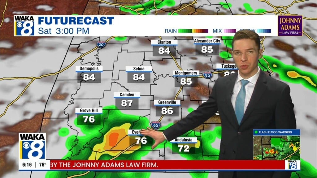
RAINFALL: We should all see another nice soaking rain as totals should be in the 1-2 inch range. Some minor flooding issues are possible in poor drainage areas, but widespread flash flooding is not expected.
FOR FRIDAY: The deep, cold core low will move across Alabama tomorrow and this will keep the sky cloudy. Expect periods of rain through the day, with even some small hail possible due the very cold temperatures a loft. It will be a rather raw and very cool day as temperatures will be struggling to climb into the lower 60s. Add in brisk northwest winds at times and it will be feeling colder. Friday night will be rather chilly with lows well down into the 40s.
EASTER WEEKEND: Saturday, as the upper trough pulls away and drier air moves into the state the sky will be clearing and we should see a sunny sky by the afternoon with highs in the mid to upper 60s. Expect a clear and chilly start to Easter Sunday as temperatures will be down into the 40s and the rest of Easter Sunday will feature sunshine in full supply with a highs in the upper 70s to lower 80s.
INTO NEXT WEEK: The weather looks to stay dry and very nice for at least the first half of the week. Days will be sunny and warm with 80s expected, while nights will be clear, cool and mostly in the 50s. Towards the end of next week, our next system will bring our next chance of rain and storms back to Alabama in the Thursday/Friday time frame.
Stay Weather Aware Tonight!
Ryan