Hurricane Sally’s Track Ultimately Determines Our Impacts
Sally has weakened some overnight, but is still a very dangerous storm which will bring life-threatening storm surge and flooding to Alabama over the next 72 hours…This is a HIGH IMPACT Event for the state of Alabama. At 400 AM CDT, the center of Hurricane Sally was located an Air Force Reserve reconnaissance aircraft and NOAA Doppler weather radars near latitude 28.9 North, longitude 88.1 West. Sally is moving toward the west-northwest near 2 mph, and this general motion is expected to continue this morning. A northward turn is expected this afternoon, followed by a slow north-northeastward to northeastward motion tonight and continuing through Wednesday night. On the forecast track, the center of Sally will move near the coast of southeastern Louisiana later today, and make landfall in the hurricane warning area tonight or Wednesday morning.
Data from the reconnaissance aircraft indicate that maximum sustained winds have decreased to near 85 mph with higher gusts. Although little change in strength is forecast until landfall occurs, Sally is still expected to be a dangerous hurricane when it moves onshore along the north-central Gulf coast. Hurricane-force winds extend outward up to 45 miles from the center and tropical-storm-force winds extend outward up to 125 miles. The estimated minimum central pressure based on data from the Air Force Hurricane Hunter aircraft is 983 mb (29.03 inches).
KEY MESSAGES: WIND: Hurricane conditions are expected to begin within the hurricane warning area this late afternoon or tonight. Tropical storm conditions are occurring in portions of the warning area across the western Florida Panhandle and Alabama, and these conditions will gradually spread westward this morning and continue into Wednesday.
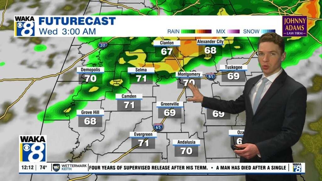
RAINFALL: Sally is expected to be a slow moving system as it approaches land producing 10 to 20 inches of rainfall with isolated amounts of 30 inches along and just inland of the central Gulf Coast from the western Florida Panhandle to far southeastern Mississippi. Historic flooding is possible with extreme life-threatening flash flooding likely through Wednesday. In addition, this rainfall will lead to widespread moderate to major flooding on area rivers.
Sally is forecast to turn inland early Wednesday and move across the Southeast producing rainfall of 4 to 8 inches, with isolated maximum amounts of 12 inches, across portions of southeastern Mississippi, southern and central Alabama, northern Georgia, and the western Carolinas. Significant flash and urban flooding is likely, as well as widespread minor to moderate flooding on some rivers.
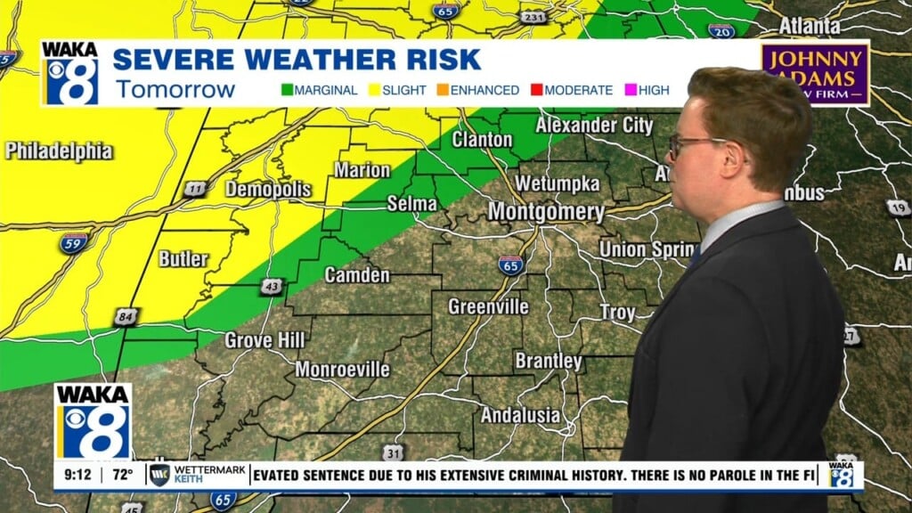
TORNADOES: A tornado or two will be possible this morning in coastal areas of the Florida Panhandle and Alabama. The tornado threat should increase and slowly spread inland the rest of today into Wednesday.
OUR IMPACTS IN CENTRAL ALABAMA: Very heavy rainfall, gusty winds, and the threat for tornadoes will be what we have to deal with in South/Central Alabama later tonight, Wednesday and into Thursday. The ultimate track of the storms determines what impacts you see at your location, but with the current track right through Central Alabama, many of us will have to deal with wind, rain, and tornadoes.
First the threat for dangerous, quick, spin-up tornadoes will push north into South Alabama through today.
Tomorrow, that threat continues for the southern third of the state.
However, the greatest threat will come from heavy rainfall and flooding, where 4-8 inches will be common and some isolated amounts over a 12 inches will be possible.
For this reason, a Flash Flood Watch is in effect from through Thursday morning.
With so much going on and a constantly changing forecast, the potential for serious flooding across the state and tornadoes, please make sure you stay informed and safe, and download the Alabama News Network Weather App.
Sally will be out of here by late Thursday, and a very nice weekend of weather is expected with plenty of sunshine, lower humidity levels, highs in the low 80s and lows well down into the 60s. Certainly a hint of fall in the air this weekend.
Stay safe!!!
Ryan


