Unseasonably Warm, Strong Storms Likely
It was a very wet night across Alabama as very heavy rainfall impacted all locations across South Alabama. Montgomery received just under one inch of rain, while some locations received over two inches.
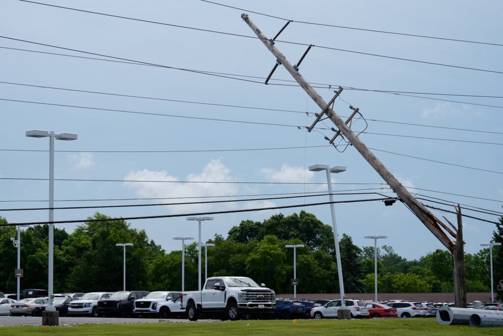
FOR TODAY: We are seeing the rain and storms exit the state, but the clouds are hanging around. It is a very warm start to the day as all locations are in the 60s. Temperatures will climb into the lower and mid-70s by this afternoon. We are also likely to see widespread showers and storms re-develop later today and impact much of the state. Severe weather is NOT expected today, but heavy rainfall of 1-3 inches will be possible through the overnight hours.
WEDNESDAY STRONG TO SEVERE STORMS: This is the day we are going to have to stay weather aware. Below is the latest convective outlook for Alabama on Wednesday. The entire state is included in a “Slight Risk” for severe weather, while locations north of Birmingham are in an “Enhanced Risk”. Click on the images below to enlarge them.

What does all this mean and what does each risk category mean?

Widespread and organized severe weather is expected, with the threats of damaging winds, hail, and even tornadoes. For us in South-Central Alabama, the main timing looks to be late Wednesday and into Thursday. There is a threat for all modes of severe weather even in our viewing area, but once again, the greatest concern will be across North Alabama. We will be keeping a careful eye on the developing situation the next 24 hours, and will keep you informed and up-to-date with team coverage.
THIS IS TORNADO SEASON: Having severe weather in November and December is NOT unusual. This is our secondary tornado season here in Alabama. Also, Alabama is the second most likely state to have tornadoes around Christmas time.
CHRISTMAS EVE: The day will start off with the threat of strong and severe storms, but we should begin to see the threat decrease. It will be another very warm day with highs in the upper 70s.
CHRISTMAS DAY: The weather stays mostly cloudy, warm, and showery. No severe weather, but showers will remain possible with a high in the upper 70s and flirting with 80F. The record high for Christmas Day is 81, set in 1987.
WARM WEEKEND: No real change. Warm with a chance of showers Saturday and Sunday. Mostly cloudy both days with a high in the mid to upper 70s.