Very warm weather continues, spotty showers before this weekend
Low clouds and fog filled the sky in parts of central and south Alabama Wednesday morning, but that mixed out by midday. Sunshine was abundant around noon, and Wednesday afternoon remains partly to mostly sunny, dry, and warm with high temperatures near 80°. Low clouds and fog may develop across part of our area again late Wednesday night, with temperatures cooling into the mid to upper 50s.
Low clouds/fog mix out again by Thursday afternoon. The sky then remains partly to mostly sunny for the rest of the day. However, stray showers appear possible during the afternoon. Although, the chance for rain remains a mere 10% or so. That means the vast majority of our area remains dry. Even if you do see rain Thursday afternoon, it may only amount to some raindrops for a very short time. Temperatures remain warm, with highs in the low 80s.
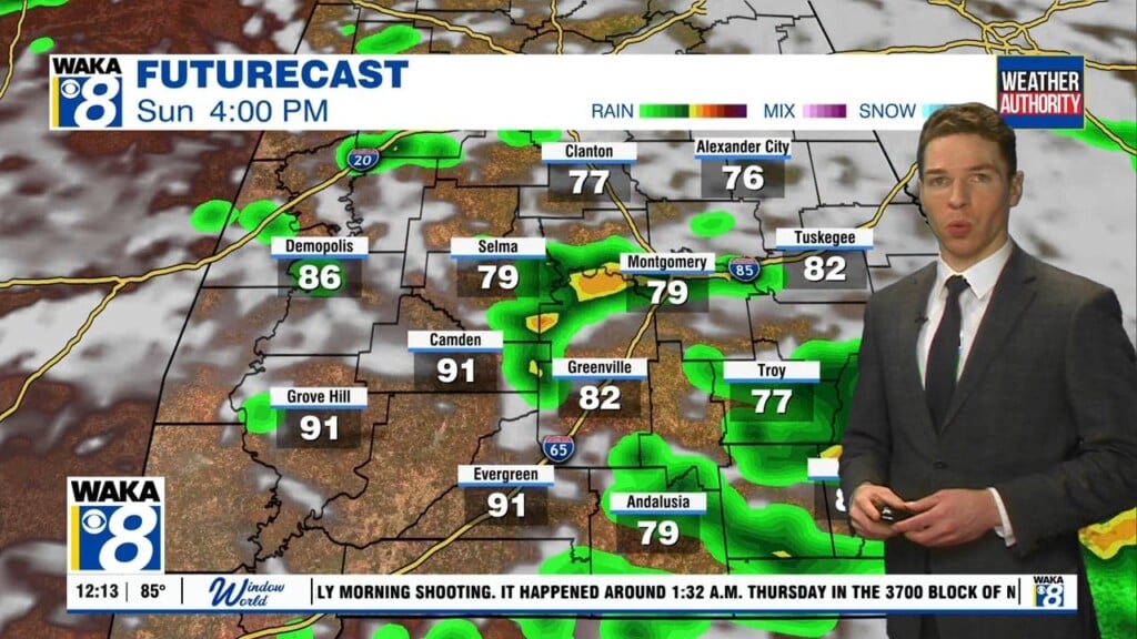
Rain chances remain low overall, but do increase slightly Friday and this weekend. Isolated showers, possibly with a little thunder form Friday afternoon. Otherwise, expect a partly cloudy sky with highs in the low to mid 80s. Showers and perhaps some storms become widely scattered Saturday and possibly Sunday. Again, temperatures remain warm this weekend, with highs in the low to mid 80s.
Our area remains somewhat unsettled early next week, with isolated to widely scattered daytime showers or storms Monday. Tuesday looks drier, though our chance for rain and possibly storms increases Wednesday, when models show a cold front heading our way. That front may also cool temperatures late next week. However, next week begins warm, with high temperatures still in the low to mid 80s Monday and Tuesday.
For local news, click here.