Warm days and cool nights, sunshine, no rain through this weekend
Thursday remains another pleasant, seasonable spring day with a mainly sunny sky, low humidity, and an east breeze. Temperatures warm into the upper 70s. Thursday night lows fall to near 50° again. Our area remains dry with sunshine through the end of the week. Temperatures warm to around 80° Friday with a partly to mostly sunny sky. But Friday night looks cool again with low temperatures in the low 50s.
Our weekend weather looks pleasant too, with a partly to mostly sunny sky Saturday and Sunday. Temperatures trend a bit warm, with high temperatures in the low to mid 80s Saturday, and mid 80s Sunday. However, overnight low temperatures fall into the 50s each night. Our area remains dry early next week, though humidity rises as winds turn more south to southeasterly through Tuesday. Temperatures remain very warm, with highs in the mid 80s.
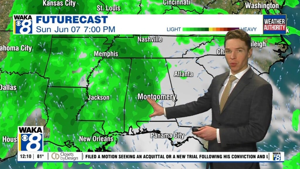
Our chance for rain remains very low through the end of the week. Spotty showers appear possible Thursday as a cold front at least approaches the southeast. However, that front likely stalls and fizzles out to our northwest. The U.S, drought monitor released Thursday April 9 shows persistent level 3 to level 4 (severe to extreme) drought across southeast Alabama. Any improvements in next week’s drought monitor look very unlikely.
Click here for more from WAKA Action 8 News.