Dry, warm through Saturday; A weekend cold front with rain Sunday
Thursday afternoon looks dry with a partly to mostly sunny sky, and temperatures warming into the mid 80s. Thursday night looks mostly clear with lows near 60°. Friday looks partly cloudy, dry, and very warm with high temperatures in the upper 80s, maybe to 90° in a few locations. Friday night trends milder, with lows near 60° and some fog possible late through early Saturday morning.
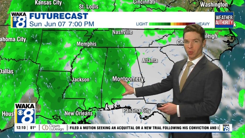
Our area remains dry with a mix of sun and clouds Saturday. Temperatures warm into the upper 80s during the afternoon. However, a cold front arrives Saturday night. Some showers move through our area early Sunday. However, rain amounts look rather light, so the level 3 (severe) to level 4 (extreme) drought conditions covering most of our area likely remain unchanged.
Our area trends drier and cooler late Sunday as the cold front pushes southeast of our area. Sunday night low temperatures fall into the 40s. Monday looks like a pleasant spring day- sunshine, low humidity, and high temperatures in the 70s.
Click here for more from WAKA.