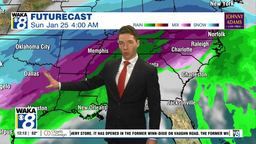
Author: Shane Butler

Rain/Storms Through Midweek

T.D. Cristobal continues to slowly pull away but deep tropical moisture lingers over the region. As a result, showers and storms will develop over us through midweek. There could even be a few strong to severe storms as a frontal boundary moves through the area on Wednesday. The main threat will be damaging winds. The front moves south of us…

Rain Chances Increase This Weekend

The hot and humid days of summer are here until further notice. The rest of this work week will be more of what you’ve seen the last few days. Temps start out in the upper 60s to lower 70s and climb into the upper 80s to lower 90s. Moisture continues to stream into the area and this is fuel for…

Warm & Humid With Daily Showers/Storms

A warm and humid air mass has taken over our weather and its sticking around for a while. High pressure to our east will continue to funnel moisture from the gulf into the state. This will lead to scattered showers and storms each day. We may stay under severe storm criteria but storms that do develop will be capable of…

So much for a drier weather pattern across our area this week. It now looks like gulf moisture will continue to flow into the state and this will lead to occasional showers and storms. There will still be ample sunshine and this will aid in temps warming into the upper 80s to around 90 degrees each afternoon. We’re watching the…

Sunny & Drier For A Change

A frontal boundary will be making a run at the deep south Saturday. Its passage will sweep out the rain activity and return us to a drier weather pattern for several days. High pressure builds in behind the boundary and this will live us with sunny skies for a change. Temps will start out rather mild for a few mornings….

Drier Days Ahead

This active weather pattern is slowly but surely winding down. A frontal boundary will move through the state and push all the rain activity to our east. High pressure will build in behind the frontal passage and this will allow us to dry out for several days. In the mean time, scat’d showers and storms will be possible again Friday….

Rain/Storms Through Late Week

This cloudy and wet weather pattern will be sticking around through Friday. An area of low pressure to our west continues to help funnel moisture into the area. This will lead to more showers and storms each day. Some storms could be strong to possibly severe with the main threat damaging winds. Daytime high temps will manage mid to upper…

Keep The Rain Gear Handy This Week

A cloudy and rainy weather pattern is hanging around this week. Moisture continues to stream into the state leading to showers and storms. The clouds and rain activity will help hold the heat down just a bit with highs dropping back into the lower to mid 80s for a few days. It looks like this weather setup will stick around…

More Rain Activity Ahead This Week

Moisture continues to stream into the area and with the daytime heating we get afternoon showers and storms. We see the chance and coverage of rain activity to increase across the area this week. Showers could even develop earlier in the day and that will have an impact on temperatures. Highs will come down a bit due to clouds and…

Showers & Storms Each Day

A rather moist southerly flow will continue to transport moisture into the area this week. This will be the fuel for daily scattered afternoon showers and storms. Any storms that do develop will be capable of heavy rain, lightning, gusty winds, and hail. Thanks to the afternoon rain activity, highs temps will come down just a bit. It looks more…