Tricky Halloween Forecast…Warm Morning, Cold Evening
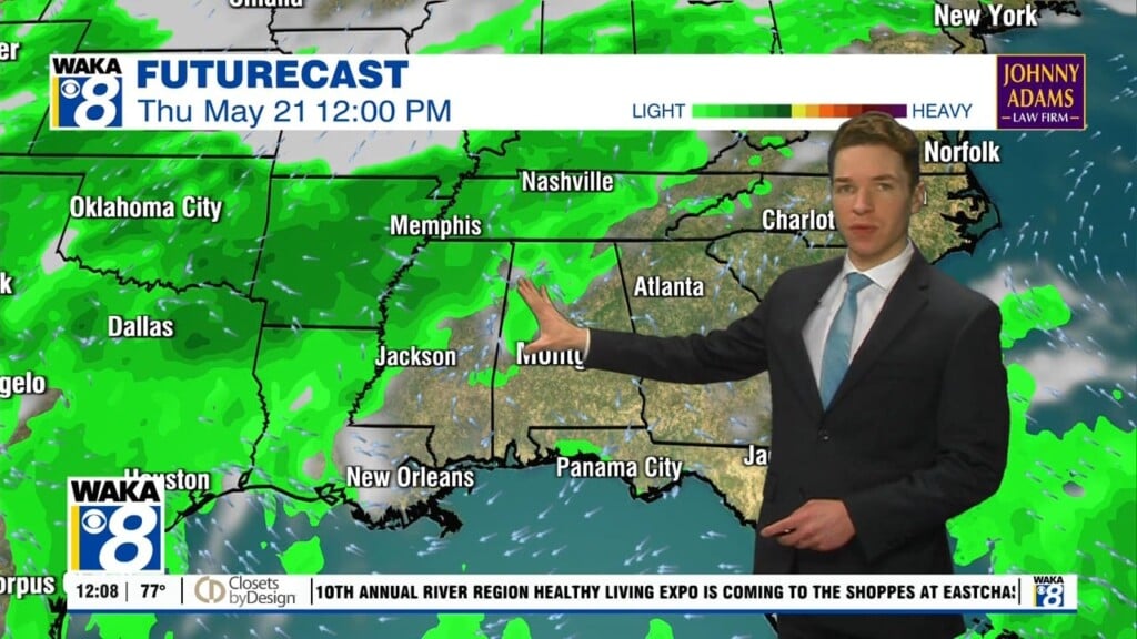
TRICKY HALLOWEEN FORECAST: Rain and storms this morning out ahead and along the cold front, and we should continue to see light rain through the afternoon hours behind the front. The high today is occurring this morning, as the cold front will deliver the coldest air of the season so far into Alabama as we head through the day. The cold air is arriving in Northwest Alabama this morning, and then spills south and east through the state during the morning and afternoon hours, and the front should be exiting the state by early afternoon. Temperatures will fall rapidly behind the cold front, and by early afternoon most communities across South/Central Alabama should be falling into the 50s with a brisk northwest wind. Rain will end from northwest to southeast during the afternoon, and most all of the rain will be gone by evening, so most trick or treaters will have dry conditions for their fun, but it will be cold and blustery as temperatures should be heading into the 40s.
COLD START TO NOVEMBER: By tomorrow morning, the sky will be clear and this will be the coldest morning since last spring across the state. Lows should be well down 30s to start the day. Friday will be sunny and cool, with highs in the upper 50s to lower 60s. Saturday and Sunday look to feature dry weather with plenty of sunshine; highs will be in the lower 60s, while lows in the 30s are expected both mornings, with even some frost in many locations.
FOOTBALL WEATHER: Clear and cold for the high school games in the state Friday night; temperatures will fall into the 40s.
Saturday evening, Auburn hosts Ole Miss (6:00p CT kickoff)… the sky will be clear with temperatures falling from near 54 at kickoff, into the 40s by halftime.
TIME CHANGE: Daylight Saving Time ends this weekend; we will set the clocks back one hour late Saturday night, which means you should get an extra hour a sleep, if you are lucky. But we are going to start seeing those earlier sunsets and the sunset time on Sunday will be 4:53PM CST.
INTO NEXT WEEK: The mainly sunny, dry fall weather will continue into next week, with temperatures slowly moderating, highs return to the lower and mid 70s. For now, the next chance of significant rain looks to arrive late next week or perhaps the following weekend, with our next another cold front.

IN THE TROPICS: At 500 AM AST, the center of Subtropical Storm Rebekah was located near latitude 39.7 North, longitude 36.7 West. The storm is moving toward the east-northeast near 21 mph, and this general motion is expected to continue today. A turn back toward the east and east-southeast is anticipated tonight and on Friday. Maximum sustained winds are near 45 mph with higher gusts. Little change in strength is expected today, but gradual weakening is forecast to begin by this afternoon or tonight. Rebekah should become a post-tropical cyclone by this afternoon or evening. The estimated minimum central pressure is 987 mb (29.15 inches).
Have a Happy Halloween!
Ryan