Feels Like August in Alabama To Me
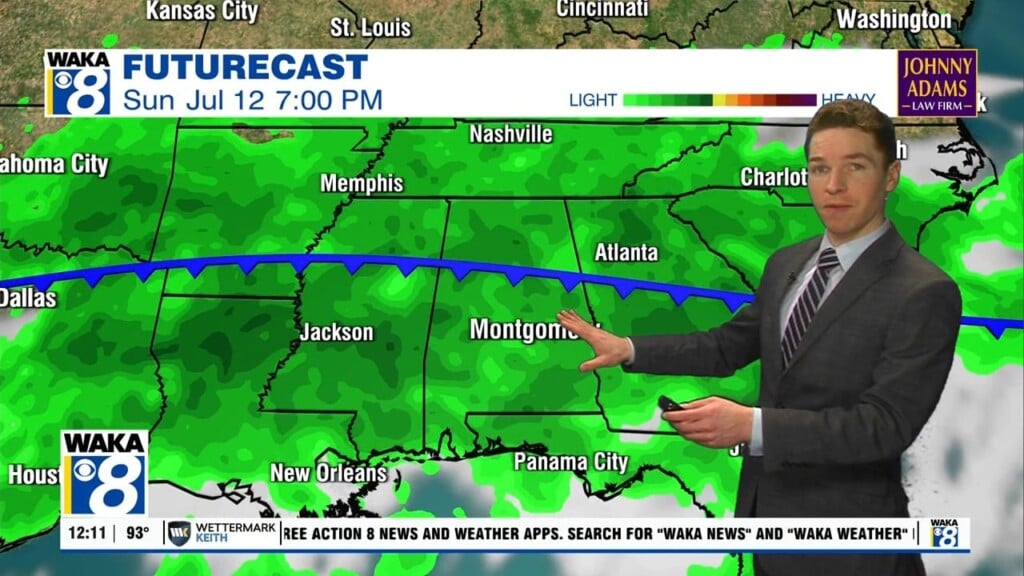
HOT, HUMID, SOME STORMS: For today and tomorrow, rain and storm chances will increases as a colder pocket of air move into the mid-levels which means a more unstable air mass, which will be promoting scattered, to numerous showers and thunderstorms, most active during the afternoon and evening hours. Rainfall could be heavy at times and some areas of flash flooding will be possible under the more intense tropical downpours; also, a some strong storms will be possible. Highs for Central and South Alabama will be in the low and mid 90s.
THE ALABAMA WEEKEND: Heat levels are on the rise as an upper ridge begins to build into the Deep South. Rain chances will trend downward with only scattered storms possible Saturday afternoon, but much of the state will be dry Sunday with only isolated showers. Highs in the mid 90s are in the forecast.
HOT NEXT WEEK: Mainly sunny and hot weather highlights our forecast for next week as the upper-ridge holds in place. Showers and storms will remain rather isolated, and temperatures will be in the low and mid 90s. Heat index values will likely be over 100°, and may approach the 105° Heat Advisory criteria at times.
IN THE TROPICS: We have Hurricane Grace and soon to be Hurricane Henri…good news, neither will impact Alabama nor the Northern Gulf Coast.
HURRICANE GRACE: The center of Hurricane Grace was located near latitude 20.0 North, longitude 87.2 West. Grace is moving toward the west near 17 mph. A general westward to west-northwestward motion is expected through Friday, followed by a general westward to west-southwestward motion. On the forecast track, Grace is expected to make landfall in the eastern Yucatan Peninsula during soon, move across the Yucatan Peninsula today, and move over the southwest Gulf of Mexico late tonight through Friday.

Maximum sustained winds are near 80 mph with higher gusts. Some slight strengthening is still possible before landfall on the Yucatan Peninsula. Grace is expected to weaken as it crosses Yucatan, but re-intensification is expected when the center reaches the Gulf of Mexico. Hurricane-force winds extend outward up to 35 miles from the center and tropical-storm-force winds extend outward up to 140 miles. A Weatherflow station located at Cancun, Mexico, recently measured a sustained wind of 56 mph and a gust to 79 mph, while another Weatherflow station located at Puerto Morelos, Mexico, recently measured a sustained wind of 51 mph a gust to 70 mph. On Cozumel, a sustained wind of 41 mph and a gust to 60 mph was observed at the Cozumel Lighthouse, while a sustained wind of 40 mph and a gust to 64 mph were measured by a Weatherflow site near the airport. The estimated minimum central pressure is 986 mb (29.12 inches).
HENRI: the center of Tropical Storm Henri was located near latitude 29.5 North, longitude 69.5 West. Henri is moving toward the west near 9 mph. A turn toward the northwest is forecast on Friday, followed by an acceleration toward the north and north-northeast Saturday and Sunday. On the forecast track, the center of Henri will remain well offshore the east coast of the United States over the next couple of days but could approach southeastern New England on Sunday.

Maximum sustained winds are near 70 mph with higher gusts. Some strengthening is forecast during the next few days, and Henri is expected to become a hurricane by Friday.Tropical-storm-force winds extend outward up to 80 miles (130 km) from the center. The estimated minimum central pressure is 995 mb (29.39 inche).
Have an amazing Thursday!!!
Ryan