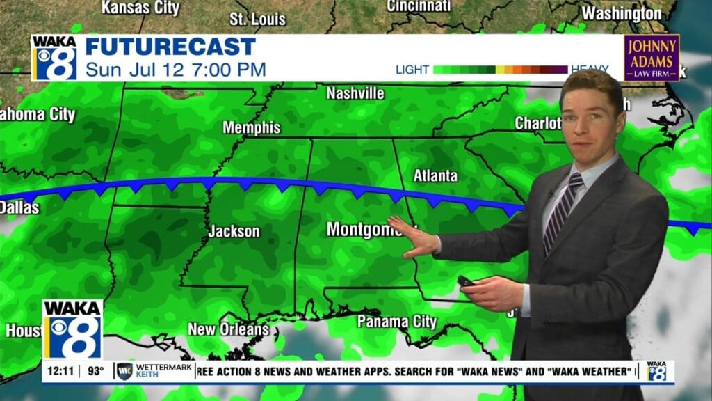
Rain and Storms Today; Front Brings Lower Humidity Tomorrow
We will maintain scattered to numerous showers and storms in the forecast for today and we will be seeing a mix of sun and clouds with highs in the mid to upper 80s. A lot of locations will get rain today, while others stay dry. Any storm today will produce a lot of lightning and heavy rainfall.
FRONT ON THE WAY: Through the day tomorrow, a front will drop into the state from the north, and it will bring a much drier air mass into the state setting the stage for another very nice September weekend of weather for Alabama. Friday morning lows will be in the lower 60s across the area. For Friday, Saturday, and Sunday, expect sunny, dry days and it will remain comfortable. Highs Friday will be in the mid 80s, followed by upper 80s Saturday and Sunday, with continued refreshing mornings.
FOOTBALL WEATHER: Expect perfect weather for the high school games across the state Friday night; the sky will be clear with temperatures falling from the upper 70s at kickoff into the upper 60s by the final whistle.
Saturday, Auburn hosts Alabama State at Jordan-hare Stadium (11a CT kickoff)… look for a sunny sky during the game with temperatures rising from near 84 degrees at kickoff to around 87 by the fourth quarter.
Alabama will host Mercer at Bryant-Denny Stadium (3p CT kickoff)… the sky will be sunny with temperatures falling from 88 degrees at kickoff to near 80 degrees by the end of the game.
INTO NEXT WEEK: For now, Monday looks mainly dry, but by Tuesday scattered showers and thunderstorms return to the forecast on a daily basis through Friday. Highs much of next week will be in the mid to upper 80s, which is right where they should be this time of year.

IN THE TROPICS: Disorganized cloudiness and a few thunderstorms over the central and eastern Gulf of Mexico are associated with a surface trough and an upper-level disturbance. The system is expected to move northeastward over the northeastern Gulf of Mexico later today.Upper-level winds could become slightly more favorable to support some tropical or subtropical development as the system nears the northern Gulf coast tonight or early Thursday. The disturbance is then expected to cross the southeastern United States, and some additional development will be possible after it emerges off the southeastern United States coast late this week. Regardless of development, areas of heavy rainfall will be possible across portions of the Florida panhandle and southern Georgia through Thursday, with localized flooding possible. Formation chance through 48 hours…medium…50 percent.
HURRICANE LARRY: the large eye of Hurricane Larry was located near latitude 26.5 North, longitude 57.3 West. Larry is moving toward the northwest near 10 mph, and this general motion is expected to continue through today. A turn toward the north-northwest and north with an increase in forward speed is forecast on Thursday. A faster northeastward motion is expected by Friday. On the forecast track, the center of Larry should pass east of Bermuda on Thursday.

Maximum sustained winds are near 115 mph with higher gusts. Larry is a category 3 hurricane on the Saffir-Simpson Hurricane Wind Scale. Gradual weakening is forecast during the next several days, but Larry is expected to remain a hurricane during that time. Larry is a large hurricane. Hurricane-force winds extend outward up to 70 miles from the center and tropical-storm-force winds extend outward up to 185 miles. The estimated minimum central pressure is 967 mb (28.56 inches).
Have an exceptionally whimsical Wednesday!!!
Ryan