More rounds of showers and some storms Mother’s Day weekend
Friday morning was mainly cloudy, but most of our area was dry through midday. However, showers and some storms were moving towards southwest Alabama. The southwest part of the state has the best chance for rain and thunder Friday afternoon and evening. Although, all of our area may see rain at some point through Friday night. Otherwise, the mainly cloudy sky and rain at times hold temperatures in the 70s Friday afternoon.
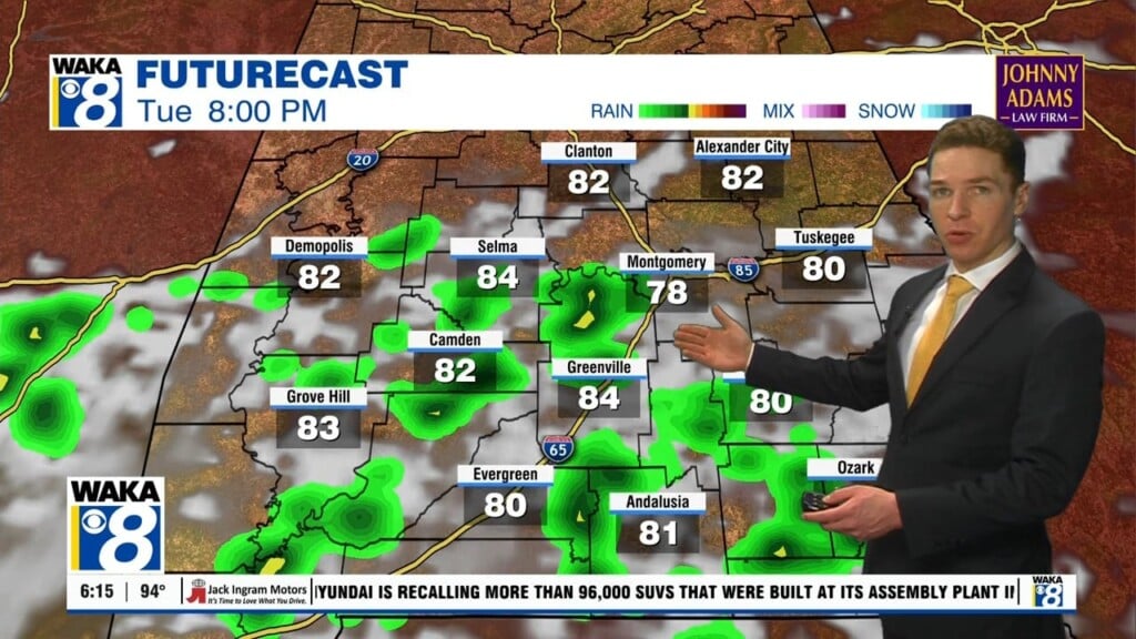
More rounds of showers and storms affect central and south Alabama Mother’s Day weekend. Rain and thunder appear possible throughout Saturday, coverage remains scattered. That means at any given time, it rains in some locations, but not others. A few storms may become strong to severe in far south Alabama Saturday afternoon, capable of damaging wind gusts and hail.
Mother’s Day looks partly to mostly cloudy with high temperatures in the mid 80s. Showers and storms become scattered about again during the afternoon. A few storms may become strong to severe across far south Alabama, capable of damaging wind and hail again. Some rain and thunder may continue Sunday night into Monday in advance of a cold front. It looks like that front pushes through and southeast of our area sometime Monday.
Our area trends drier by Monday night, and cooler with lows in the 50s. Next week looks mainly dry and warm at this time, with a partly to mostly sunny sky each day. High temperatures rebound into the mid 80s Wednesday through Friday. Although, low temperatures may continue to fall into the 50s through Thursday night. Our area may remain dry next weekend, with temperatures potentially trending towards the upper 80s.