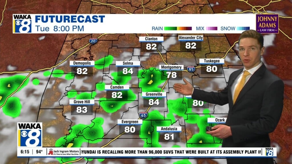
Heat advisory continues Tuesday with a few severe storms possible
Monday was a very hot and humid day across central and south Alabama. High temperatures were in the mid 90s in many locations. Meanwhile, heat indices were between 100 and 105° for much of the afternoon. Additionally, the sky was partly to mostly sunny with no cooling showers or storms. However, afternoon/evening showers and storms return Tuesday. A few storms may become strong to severe, capable of damaging wind gusts up to 60 mph.
A marginal (level 1/5) severe risk covers our area Tuesday. Otherwise, a heat advisory continues through 9PM Tuesday for central Alabama. Afternoon heat index values may peak near or above 105° again. For those outdoors for a long time, take more fequent breaks in the shade (or ideally and air conditioned place) and stay hydrated to avoid heat exhaustion and heat stroke.
In the meantime, Monday night looks mostly clear with lows in the mid 70s. High temperatures may reach the mid 90s Tuesday through Independence Day. Meanwhile, peak heat indices range from 100 – 105°+. Afternoon/evening shower/storm coverage looks isolated to widely scattered each day. Rain coverage may increase further after the 4th of July, which may reduce our afternoon heat. High temperatures may range from the upper 80s to low 90s much of next week.