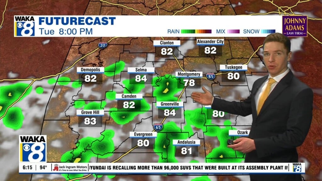
Clouds linger, showers south Tuesday; Dry for the rest of this week
Our Tuesday afternoon weather differs from one location to another. Locations west of I-65 get a partly to mostly sunny sky with high temperatures in the 70s to low 80s. East of I-65, the sky remains mainly cloudy with highs in the 70s. In far southeast Alabama, a few showers remain possible. The sky clears at least partially Tuesday night, with lows in the mid to upper 50s.
The rest of this week looks partly to mostly sunny and dry. Temperatures warm into the mid 80s each day. Overnight lows remain a bit cooler, falling into the 50s at least Wednesday and Thursday night. In fact, temperatures may fall into the upper 40s in some locations Thursday night. Our weekend weather looks warmer, with high temperatures in the upper 80s Saturday and Sunday. Both days remain partly to mostly sunny and dry.
Temperatures approach 90° next week. Meanwhile, our area likely remains dry on Monday. However, a small chance for rain may return around the middle of the week. Longer-range models suggest a cold front approaches Alabama at that time. Although, this is close to the time of year in which fronts tend to stall on their way to Alabama. Rain coverage looks low at this time around Wednesday of next week.
Click here for more from WAKA.