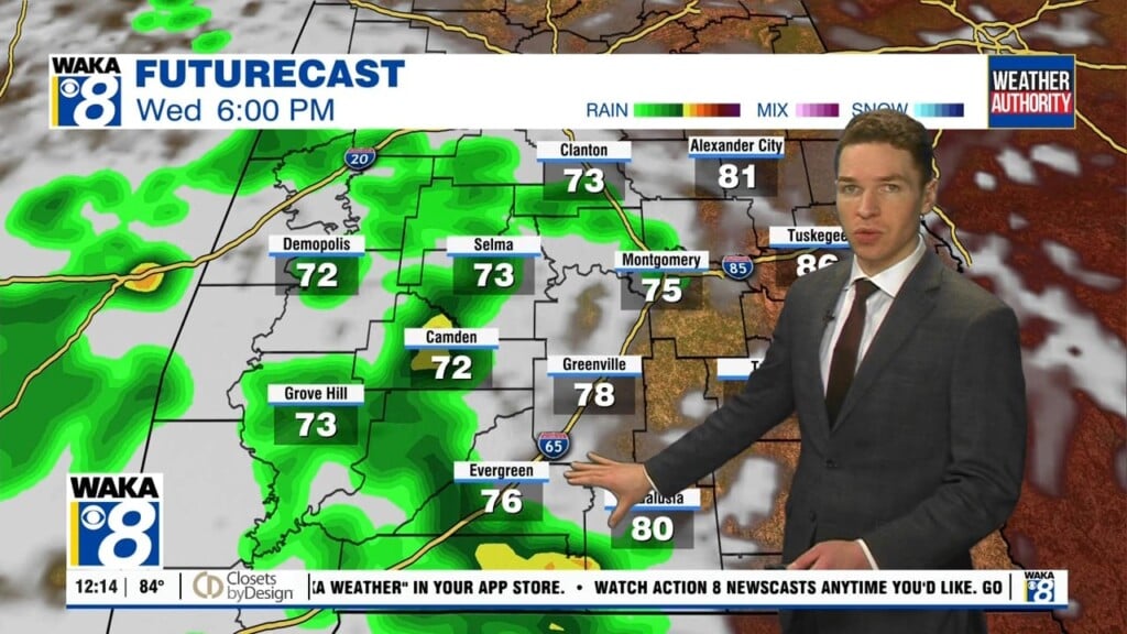
A Little Heat Relief Ahead
More dangerous heat ahead as we go into the workweek! Temps will soar into the upper 90s for highs but when you factor in the humidity, it will feel even hotter. Heat indices (feels Like) will range between 105 to 115 degrees Monday afternoon. We suggest you slow down and take it easy on these really hot days. Scattered showers and storms will be around and actually help knock the heat down in spots. There’s even more promising heat relief ahead for midweek. A frontal boundary will move through the area Tuesday. The air behind the boundary is drier and that will feel rather nice considering how its felt around here lately. We expect blue skies and temps down into the lower 90s for a few days. Overnights will be nice and milder with mid to upper 60s possible Thursday and Friday mornings. It begins to warm up a bit as we head into the latter half of the week. We’re back into the mid and upper 90s for afternoon highs. Rain chances will be low but those pop up showers and storms can’t be ruled out over that following weekend.