The Rain Isn’t Done With Us Just Yet
Our cloudy and rainy weather pattern continues but we do see an end in sight. There will be a few more rounds of rain to work through the area and rainfall could be heavy at times. There’s even a threat for strong to severe storms Saturday.
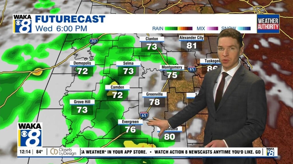
In the meantime, cloudy and rainy conditions are likely again tonight. The clouds will help slow the cooling and overnight temps will only drop into the lower to mid 60s.. We’re expecting lower to mid 70s to return Friday. It’s looking like the bulk of the heavy rainfall will pass along our southern counties and into the Florida panhandle.
Precipitation chances will increase as we go into Saturday. This will be the last in a series of rain makers. We expect thunderstorms to be imbedded in the rain and some storms could be strong to severe. The Storm Prediction Center does have a slight and marginal risk for severe storms covering our area Saturday. The main threats will be damaging winds and maybe a brief tornado. Rainfall potential will range between 1 to 2 inches with some spots a little higher.
Looks like we will see the parade of rain/storms come to an end later Saturday. A frontal system will sweep through Saturday night into early Sunday. This will set us up for drier conditions to return Sunday into early next week. High pressure will return and that should help keep us rainfree for a bit. Temps will drop slightly but high temps will hover near the average of 60 degrees.