Feels More Like June But Not For Long!
A real taste of summer as temps climb into the lower 90s through midweek. It’s a rather warm weather pattern and more like June than early May. We expect the summer-like heat to stick around through Wednesday but a cold front will bring an end to the heat later in the week. A cool down will accompany the frontal passage and you will notice the change this weekend.
In the meantime, we have a couple days of sunshine and hot afternoon temperatures ahead. 90 plus degree heat is likely for most of us. Some heat relief will come in the form of showers or t-storms but not all of us see them. They will be mainly isolated and during the afternoon heating and possibly linger into the evening hours.
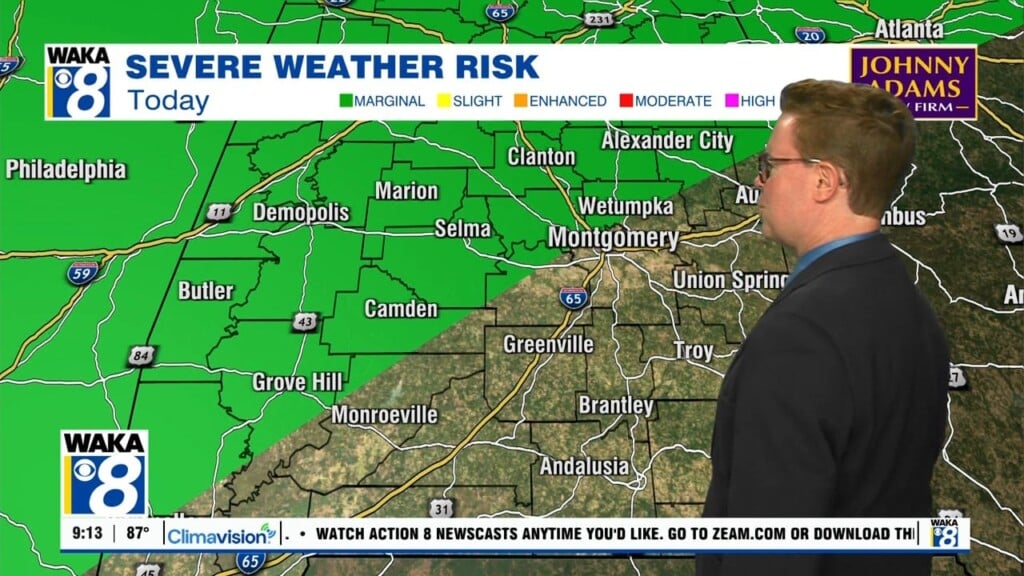
A late season cold front will make a run at the state Thursday. Rain and storms are likely and we can’t rule out a few strong to possibly severe storms. The front moves through and drier air spills into the area behind the front late Friday. This should be dry/cooler air and a welcome break from the summer-like heat from early in the week. All indications are we get nice and rather mild weather conditions for our the entire weekend.