Rain returns this week, but maybe not the widespread/soaking kind
Monday was warm and humid with a partly to mostly cloudy sky. The warm, more humid weather fuels better chances for rain this week, mainly on Tuesday and Wednesday. A handful of brief, stray showers formed Monday afternoon. However. these quickly fade away after sunset. Monday night looks partly cloudy, with low temperatures in the upper 50s to low 60s. Low clouds or fog may form early Tuesday morning.
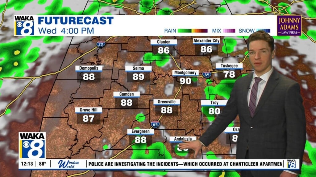
Tuesday looks partly cloudy with high temperatures in the low to mid 80s. The weather pattern for Tuesday and Wednesday looks almost summer-like for our area, with isolated to widely scattered showers or storms forming during the afternoon. Some locations may miss out on rain one or both days, while other may get heavy rain for at least a short time. Besides the chance for rain, Wednesday also looks partly cloudy with highs in the low to mid 80s.
Rain chances fall again for the end of the week, with only stray afternoon showers Thursday and Friday. Otherwise, each day looks partly to mostly sunny with highs in the low to mid 80s. Rain coverage remains very low Saturday, but showers and possibly storms look more likely on Easter Sunday. Sunday’s rain chance comes with the next cold front marching through Alabama. After it moves through, most of next week could be mainly dry and cooler.
Click here for more local news.