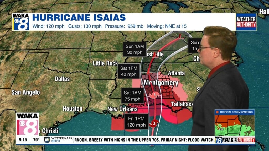
Isaias Bringing Strong Winds & Heavy Rain Our Way
Hurricane Isaias coming ashore between Pensacola and Destin Florida. It’s making landfall as a cat-3 hurricane with winds around 115 mph. Impacts from Isaias will be felt across our area tonight through Saturday afternoon.
The current NHC forecast track brings the Isaias northward into Alabama. This track would bring strong winds and heavy rain across much of our area tonight into Saturday. Wind gusts could reach 40 to 50 mph, with some areas potentially seeing gusts closer to 65-70 mph. Winds of this strength will likely bring down some trees and could lead to scattered power outages.
Heavy rainfall will also be a major concern. Rainfall totals of 2 to 4 inches, with locally higher amounts. Flash flooding could become a problem, especially in low-lying and flood-prone areas.
Areas along and east of the storm’s track will also face a tornado threat. Tropical tornadoes can develop quickly and often provide very little warning, so be prepared to move to a safe place immediately if a warning is issued for your location.
Weather conditions could begin improving around noon Saturday. Isaias is expected to increase its forward speed as it moves northward, allowing the system to exit Alabama relatively quickly.
Much calmer weather returns Sunday with mostly sunny skies. Next week is also looking mainly sunny and warm, with afternoon highs generally reaching the mid to upper 80s.